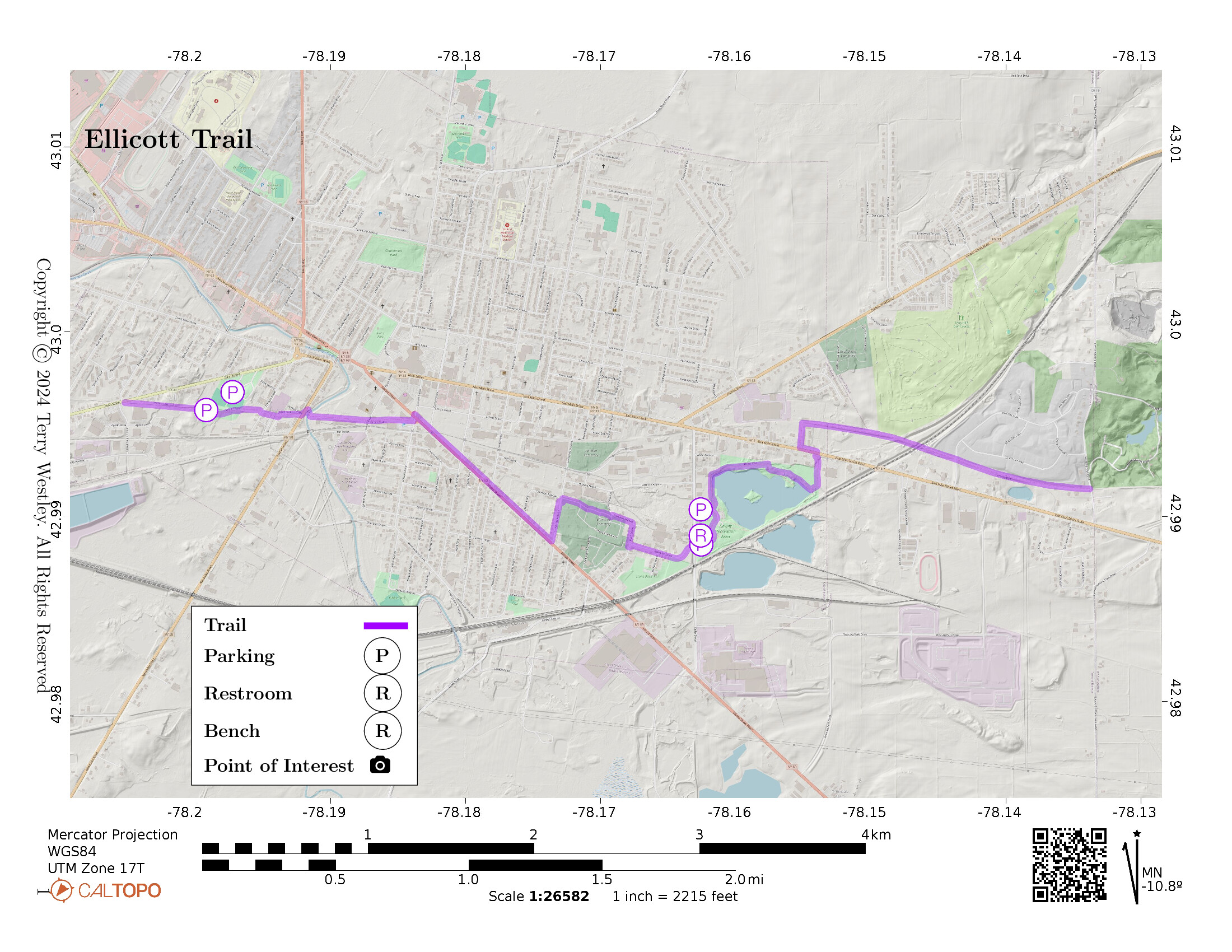
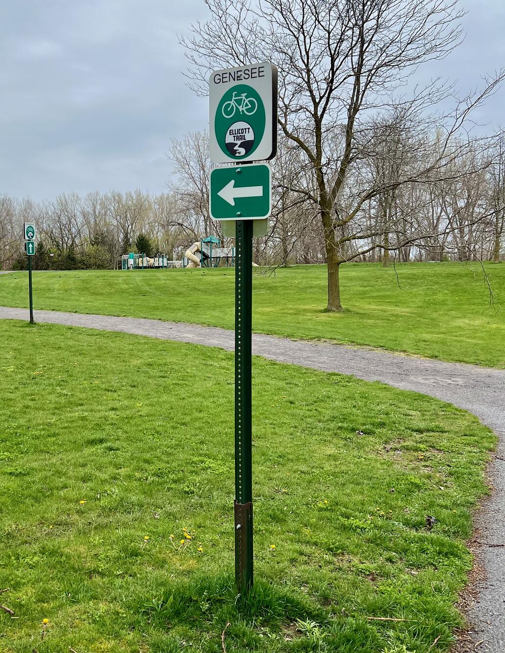
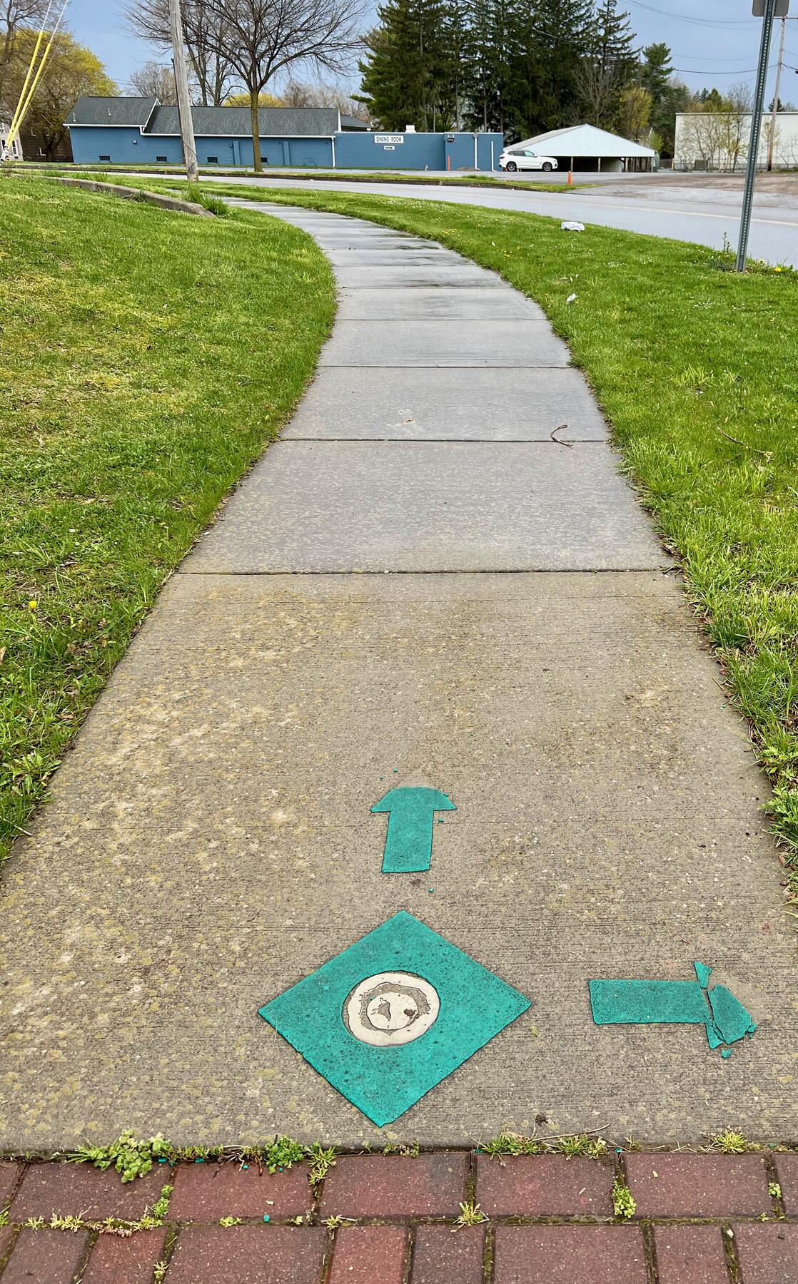
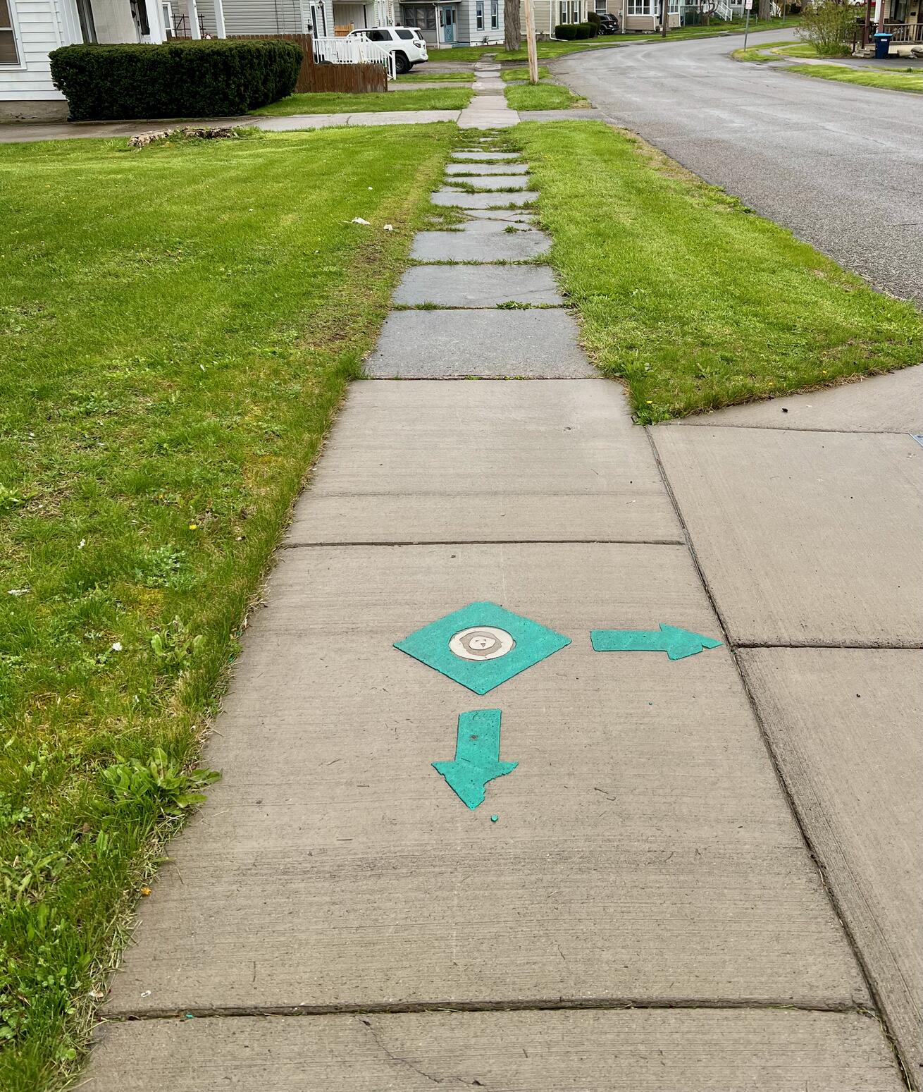
Ellicott Trail is a superbly marked 4.9 mile rail and sidewalk trail through the town and city of Batavia, NY.
It’s western terminus is at the intersection of Pearl St (SR 33) and Industrial Blvd. From there to Jackson St, it follows the former railbed of the New York City “Peanut Line” to Tonawanda. From Jackson St, the trail follows the sidewalk on Ellicott St (SR 63) to Harvester Ave. Route 63 has lots of traffic, so use care at street crossings. Because you are in town, it will not be as quiet as a walk in the woods. But on the plus side, there are several restaurants along the way. I recommend the Pok-A-Dot at the corner of Ellicott and Liberty.
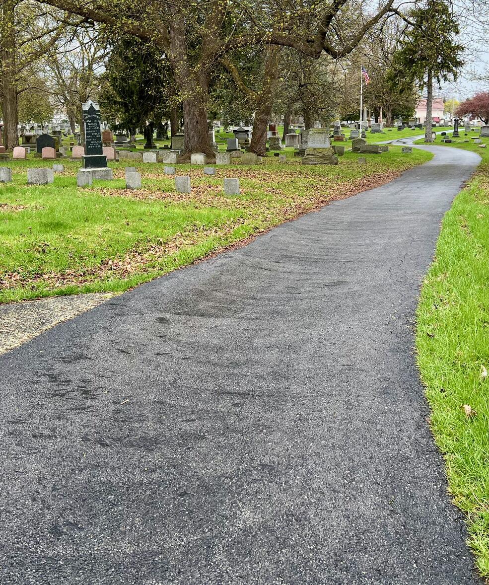
The trail proceeds through Elmwood Cemetery and on sidewalks to the Dewitt Recreation Area. Beyond the recreation area, you join up with the former railbed of the Erie Railroad Avon Branch. The railbed takes you on to the eastern terminus of the trail at Seven Springs Rd.
The elevation gain is 85 feet.
The Genesee County Chamber of Commerce promotes the trail and provides a nice map in this PDF brochure![]() .
.
Leave No Trace, Ten Essentials
While you’re enjoying the outdoors, please leave no trace![]() to minimize your impact and preserve these special places for others to use as well. If you’re walking or hiking, please pack the REI ten essentials
to minimize your impact and preserve these special places for others to use as well. If you’re walking or hiking, please pack the REI ten essentials![]() for your own safety. When cycling, consider using this REI checklist
for your own safety. When cycling, consider using this REI checklist![]() . For other activities, review the hiking and biking essentials and use your judgement.
. For other activities, review the hiking and biking essentials and use your judgement.
Parking
There are no parking lots at the trailheads. You can park in Williams Park (69 Pearl Street) and Dewitt Recreation Area (115 Cedar Street). On-street parking can also be found along Ellicott St (SR 63).
Trail Surface
The trail surface along streets is concrete sidewalks. On the railbed, it is finely crushed stone. The crushed stone is well-drained: I hiked on a rainy day and found no puddles or standing water. In Elmwood Cemetery, the trail is asphalt.
Restrooms
There is a portable toilet at Dewitt Recreation Area. Otherwise, there are no public restrooms along the trail.
Batavia City Parks says there are “restrooms available with paid reservation” at Lions and Williams Parks. (I don’t know what that means.)
There are several restaurants on, or close to, the trail which you may wish to patronize for snacks, drinks, food, and restrooms. Lacking a law to the contrary (e.g. Ally’s Law), stores are generally not required to accommodate non-customers.
Points of Interest
Restaurants along the trail include Pok-A-Dot and Angry Charlies Smokehouse & BBQ. Parks include Williams Park, Lions Park, and Dewitt Recreation Area. The beautiful bridge in the photo above crosses Tonawanda Creek. Elmwood Cemetery is a very pleasant walk and is 100% asphalt.
History
Based on maps on Todd’s Railfan Guide to Batavia, NY![]() , the eastern railbed appears to be the Erie Railroad Avon Branch, while the western railbed appears to be the New York City “Peanut Line” to Tonawanda.
, the eastern railbed appears to be the Erie Railroad Avon Branch, while the western railbed appears to be the New York City “Peanut Line” to Tonawanda.
On May 15, 2021, Mallory Diefenbach reports, Happy trail: Ellicott Trail proves to be a community asset 1 year after opening![]() :
:
The trail cost $1.6 million to build. Funding for the project was provided by the Town and City of Batavia, Genesee County, New York State Department of Transportation and State of New York.
The Ellicott Trail project won awards last month from the regional and state American Public Words Association.
Hiking Solo (and Running, etc.)
Solo hikers who find themselves able to do the whole point-to-point trail distance but not the out and back may consider using Uber or Lyft to get a ride from where they parked to the other trailhead. Then you can walk to your car from there. Since this trail is in a populated area, you won’t have long to wait for a ride. I’ve done this several times (on other trails) because I usually hike solo.
Trail Summary
| Distance | 4.9 miles point to point | 9.8 miles out and back |
| Elevation gain | 85 feet | |
| Trail surface | Concrete sidewalks, crushed stone and asphalt | |
| Difficulty | Easy for point to point | Moderate for out and back |
| Western trailhead | 42.99617, -78.20526 |
Pearl St and Industrial Blvd |
| Eastern trailhead | 42.99151, -78.13375 |
Seven Springs Rd |
| Parking | 42.99674, -78.19725 |
Williams Park |
| Parking | 42.99038, -78.16259 |
Dewitt Recreation Area |
| Parking | 42.98871, -78.16268 |
Dewitt Recreation Area South Entrance |
Maps
All Trails Map
Your free All Trails account![]() provides the capability to load and navigate trail maps. You can’t print them; that’s a premium capability.
provides the capability to load and navigate trail maps. You can’t print them; that’s a premium capability.

To load a map into All Trails app, from your smartphone’s browser, open the page you’re on right now, select Ellicott Trail and then tap this link to open the map directly into All Trails.
Or, with your smartphone’s QR scanner, scan this QR code. If you have an iPhone, open this website with the built-in Safari browser, open the Ellicott Trail page, tap and hold the QR code, and select Open from the menu.
Avenza Map
Avenza Map
- Load the PDF map into Avenza app on your smartphone in one of these ways:
- From your smartphone’s browser, tap this link to load the map directly into Avenza.
- From Avenza app’s Import Maps function, scan this QR code.

- Be sure to do this when you have good internet connection. Don’t wait until you are at the trailhead!
For more information about trail maps, see the Maps page.