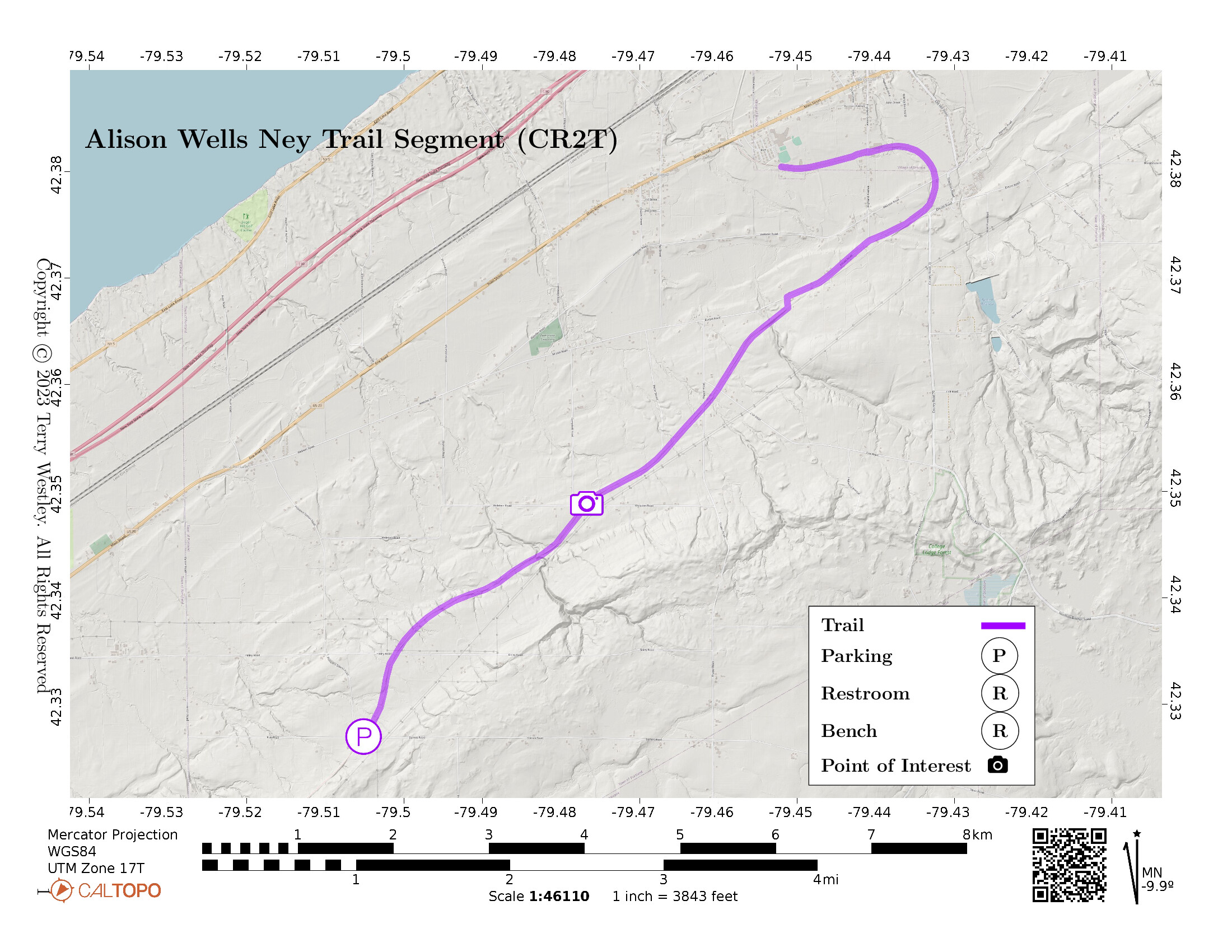
The Alison Wells Ney Trail is a segment of the Chautauqua Rails To Trails![]() (CR2T).
The trail starts at the parking lot on Prospect Station and ends at the Brocton trailhead on School Street.
The trail is 7.3 miles point to point with an elevation gain of 497 feet if you start in Brocton.
If you start at Prospect Station, the trail is downhill all the way to Brocton.
(CR2T).
The trail starts at the parking lot on Prospect Station and ends at the Brocton trailhead on School Street.
The trail is 7.3 miles point to point with an elevation gain of 497 feet if you start in Brocton.
If you start at Prospect Station, the trail is downhill all the way to Brocton.
The CR2T map![]() shows the trail’s location near Brocton, NY.
shows the trail’s location near Brocton, NY.
Leave No Trace, Ten Essentials
While you’re enjoying the outdoors, please leave no trace![]() to minimize your impact and preserve these special places for others to use as well. If you’re walking or hiking, please pack the REI ten essentials
to minimize your impact and preserve these special places for others to use as well. If you’re walking or hiking, please pack the REI ten essentials![]() for your own safety. When cycling, consider using this REI checklist
for your own safety. When cycling, consider using this REI checklist![]() . For other activities, review the hiking and biking essentials and use your judgement.
. For other activities, review the hiking and biking essentials and use your judgement.
Trail Surface
The Alison Wells Ney Trail Segment![]() web page says, “The segment from Highland
to School Street (in back of the High School) is specially surfaced as a
‘Healthy Heart’ trail,” which is about 0.6 miles long. The rest of the
trail is gravel, packed earth, and grass.
web page says, “The segment from Highland
to School Street (in back of the High School) is specially surfaced as a
‘Healthy Heart’ trail,” which is about 0.6 miles long. The rest of the
trail is gravel, packed earth, and grass.
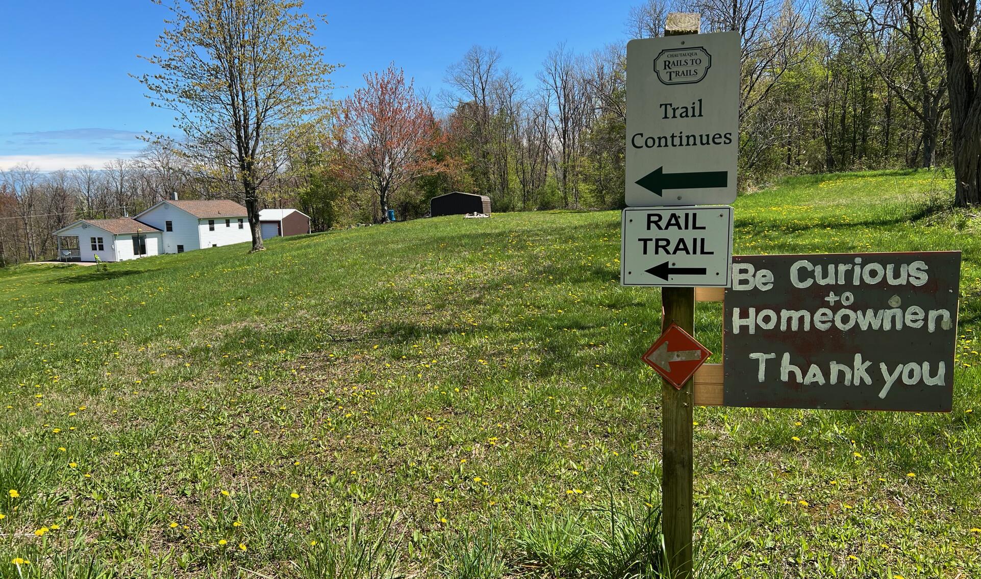
Please note there is an interruption in the trail where it follows a
paved road. The Avenza map shows where it detours via Ellicott Road from
42.368336, -79.451236![]() to 42.376013, -79.433892
to 42.376013, -79.433892![]() .
(All GPS coordinates on this page go to Google Maps.)
.
(All GPS coordinates on this page go to Google Maps.)
Please consider carefully whether this trail surface is adequate for your activity.
Restrooms
There are no public restrooms at the trailheads or along the trail.
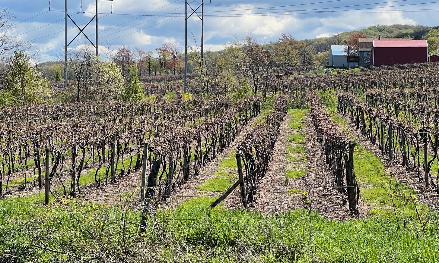
Points of Interest
A vineyard near Woleben Road is one of the highlights of the trail.
History
In private communication (Mar 8, 2023), Wendy Lewellen, Secretary, Chautauqua Rails to Trails, wrote: “Alison died in a car crash in 1993 at age 23. Her parents were both physicians in Jamestown and were hiker/nature lovers. They financed the purchase of the 9.8-mile trail to honor her. She was a wonderful star, this young woman and was completing graduate study in Russian studies and International relations.”
The trail runs along a section of the Pennsylvania Railroad’s Chautauqua
Branch. From Trainz Forge![]() :
:
The Pennsylvania Railroad (PRR) was one of the largest and most influential railroads in American history. It had a myriad of lines running from the east coast to Chicago. Four of those lines operated in Western New York and Pennsylvania, two to Buffalo, one to Rochester, and one through Salamanca and Olean to Warren and Oil City Pennsylvania.
Like most railroads, the Pennsylvania reached Buffalo, at one time the second most important railroad city beside Chicago. The PRR reached Buffalo through a route that went north from Oil City, PA through Corry, Mayville, Brocton and Dunkirk on its way to Buffalo along the shore of Lake Erie. This line is referred to as the Chautauqua Branch of the PRR. In 1968 the Pennsylvania Railroad merged with the New York Central Railroad to form the Penn Central Railroad. This lasted until 1976 when the Penn Central was merged into the new Conrail system.The Chautauqua Branch continued in operation until December 29, 1978 when the last train passed over the line. The rails were removed the following year.
Hiking Solo (and Running, etc.)
Solo hikers who find themselves able to do the whole point-to-point trail distance but not the out and back may consider using Uber or Lyft to get a ride from where they parked to the other trailhead. Since this trail is in a less populated area, you may have to wait 15 minutes or more for a ride or you may not get a ride at all. I’ve done this several times because I usually hike solo.
Trail Summary
| Distance | 7.3 miles | 13.1 miles out and back |
| Elevation gain | 497 feet | When starting in Brocton |
| Trail surface | Ballast, gravel, grass, asphalt | |
| Difficulty | Moderate | |
| Point of Interest | 42.34885, -79.47671 |
Vineyard near Woleben Road |
| Prospect Station Rd Parking | 42.32694, -79.50511 |
About 10 spaces, not paved, not striped |
Avenza Map
Avenza Map
- Load the PDF map into Avenza app on your smartphone in one of these ways:
- From your smartphone’s browser, tap this link to load the map directly into Avenza.
- From Avenza app’s Import Maps function, scan this QR code.

- Be sure to do this when you have good internet connection. Don’t wait until you are at the trailhead!
For more information about trail maps, see the Maps page.