The Ralph C. Sheldon Jr. Trail is a segment of the Chautauqua Rails To Trails (CR2T)![]() .
The CR2T Trail Segments page
.
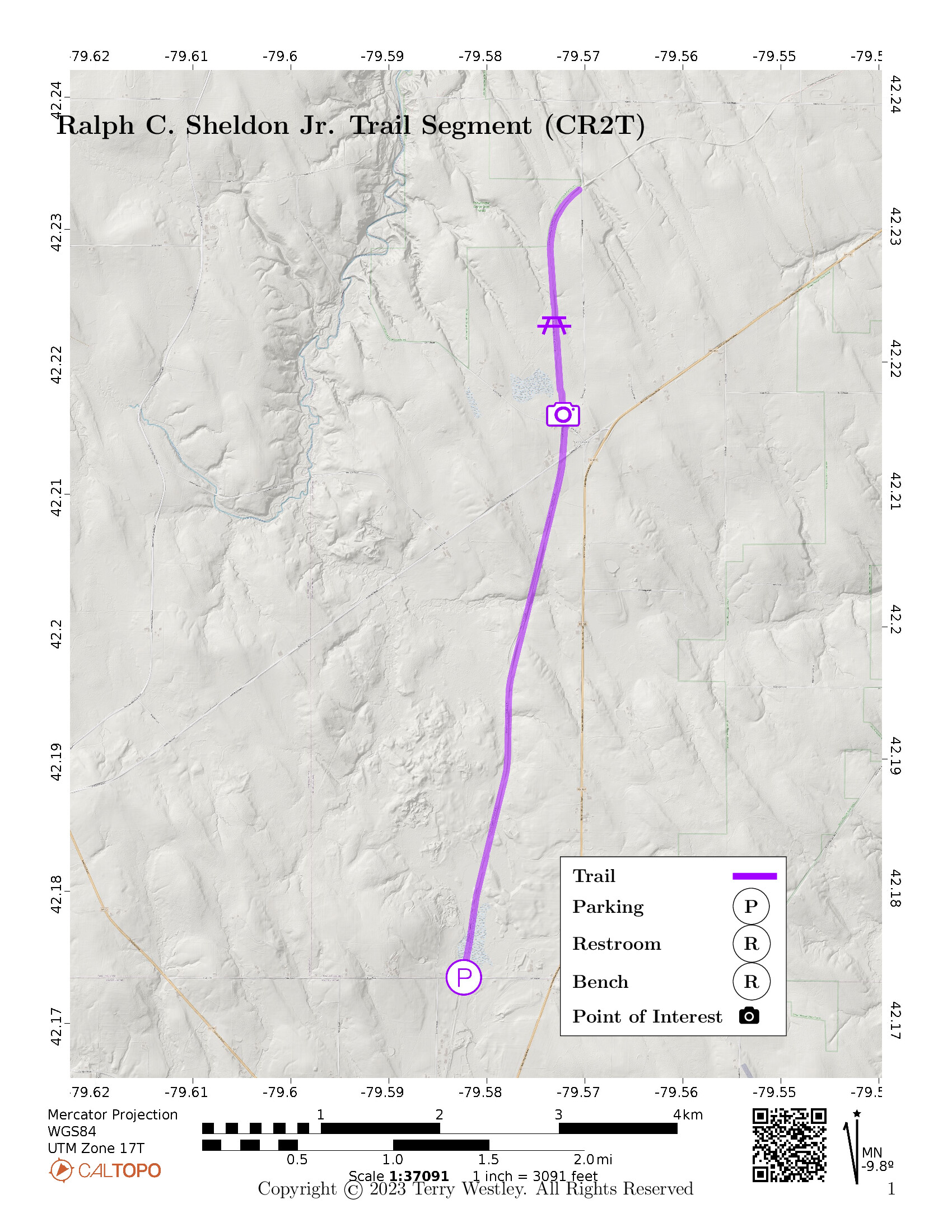
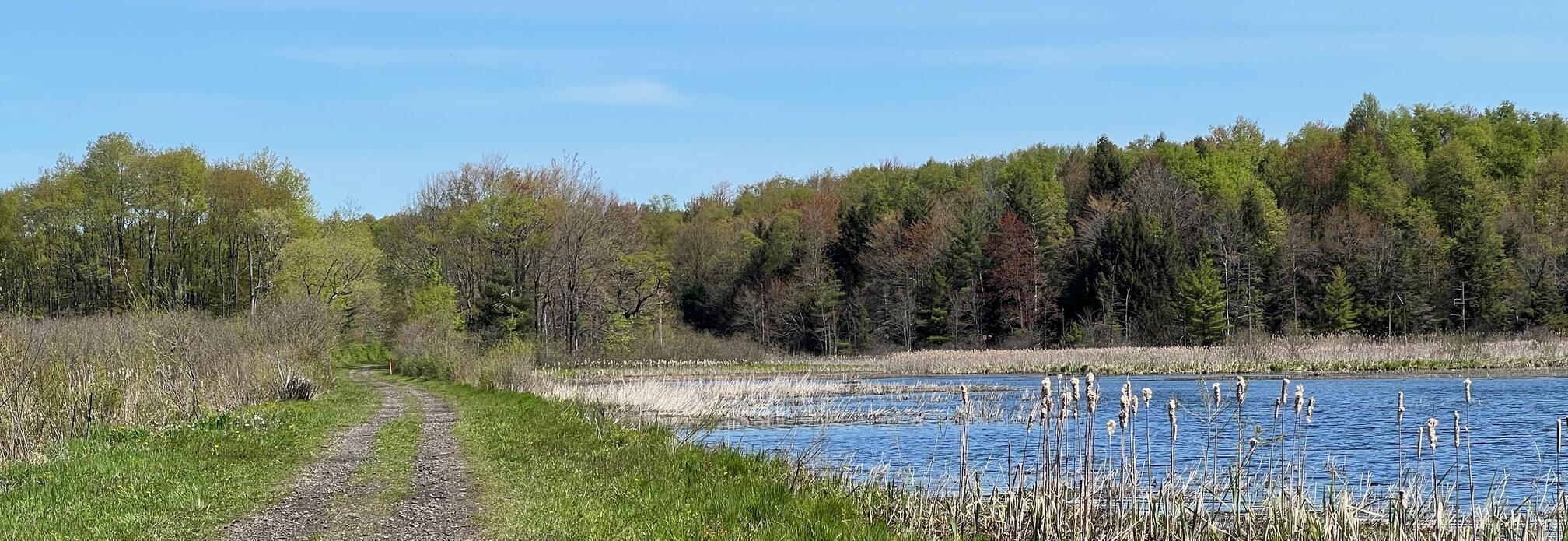
The CR2T Trail Segments page![]() says that its southern trailhead “begins at Titus Road [ed. Sherman, NY] and running northward to Summerdale Road, passes through woodlands and through wetlands which offer habitat suitable for beavers and migrating waterfowl. Parking is available at Titus Road and Summerdale Road.” The trail is 4.2 miles point to point (8.4 out and back) with an elevation gain of 92 feet.
says that its southern trailhead “begins at Titus Road [ed. Sherman, NY] and running northward to Summerdale Road, passes through woodlands and through wetlands which offer habitat suitable for beavers and migrating waterfowl. Parking is available at Titus Road and Summerdale Road.” The trail is 4.2 miles point to point (8.4 out and back) with an elevation gain of 92 feet.
There are many side trails and farm road intersections, but don’t leave the trail as the land on both sides is posted no trespassing. One exception is the Blue trail of the newly rerouted Westside Overland trail on Chautauqua Gorge State Forest land near the Summerdale trailhead.
See also CR2T’s map of the trail![]() in Sherman, NY.
in Sherman, NY.
Do not continue on the trail across Summerdale as that portion from Summerdale to Hannum is private property.
Leave No Trace, Ten Essentials
While you’re enjoying the outdoors, please leave no trace![]() to minimize your impact and preserve these special places for others to use as well. If you’re walking or hiking, please pack the REI ten essentials
to minimize your impact and preserve these special places for others to use as well. If you’re walking or hiking, please pack the REI ten essentials![]() for your own safety. When cycling, consider using this REI checklist
for your own safety. When cycling, consider using this REI checklist![]() . For other activities, review the hiking and biking essentials and use your judgement.
. For other activities, review the hiking and biking essentials and use your judgement.
Trail Surface
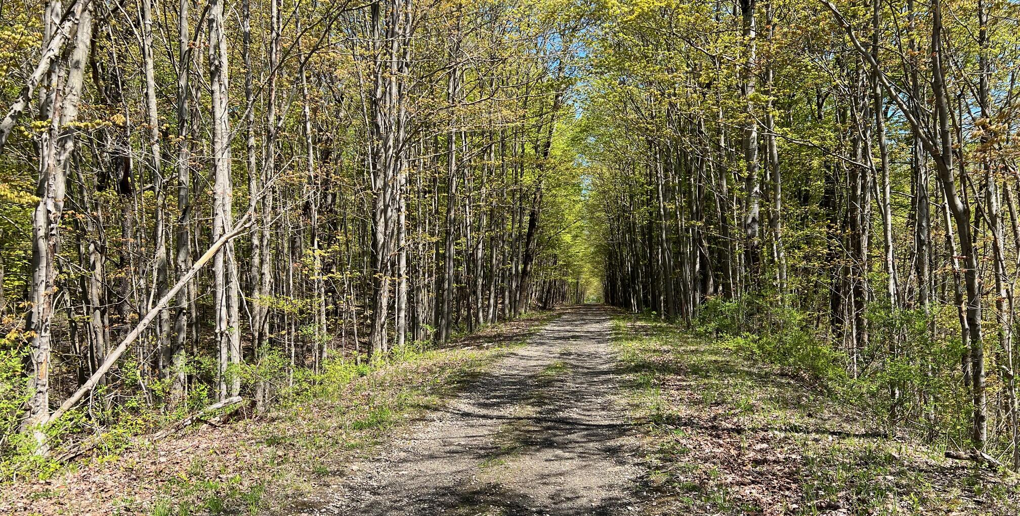
The trail surface is gravel, grass, and packed earth. There are quite a few outcroppings of stone and concrete mixed with gravel. For a portion of the last quarter, the trail follows a single lane dirt road.
Please consider carefully whether this trail surface is adequate for your activity.
Restrooms
There are no public restrooms at the trailheads or along the trail.
Points of Interest
Birders will particularly enjoy the first 1/2 mile of wetlands (starting from Titus Road). All, and especially railroad fans, will enjoy the raised portions crossing beautiful valleys on either side.
Another point of interest is a ruin that is probably the remains of a bridge abutment. You can see them on both sides of the creek.
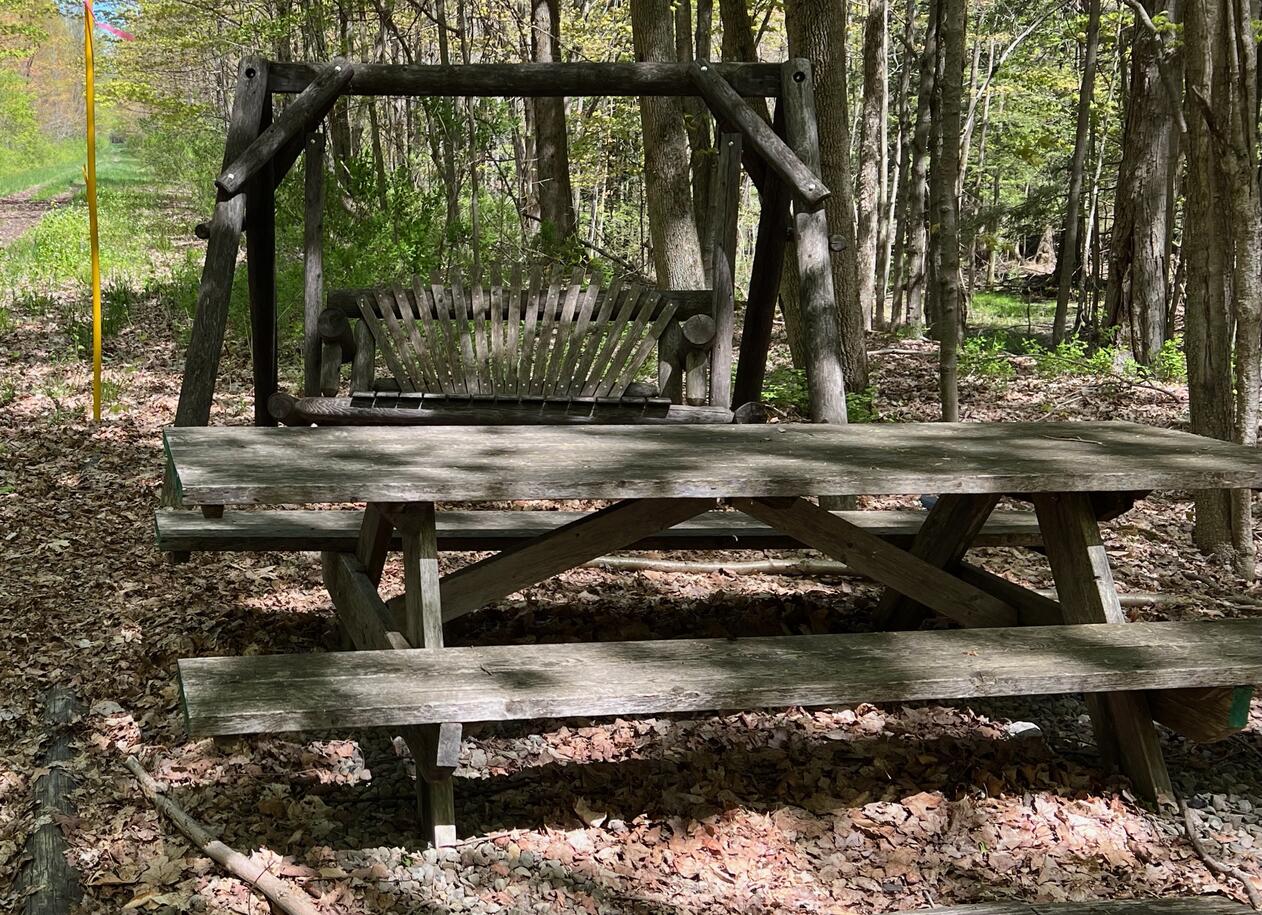
There’s a picnic table and swing just before you get to the intersection with the Westside Overland Trail.
History
From private communication (Mar 8, 2023) from Wendy Lewellen, Secretary, Chautauqua Rails to Trails:
Ralph Jr. (for whom the trail is named) was the grandson of Porter Sheldon who made the money that provides the capital today for the Ralph C. Sheldon (Sr.) Foundation
which is a major philanthropic entity in the southern half of Chautauqua County. Porter invented a special photographic paper. He and his investors eventually sold it to George Eastman and were paid in stock which went up exponentially. His son, Ralph Sr., was also a pillar of the Jamestown community whose widow, Isabella, created the Foundation. His son, Ralph Jr., for whom the trail is named, was stricken with polio at age 7, but was an upstanding community citizen nonetheless. He was for a good bit of time part owner of LS Aeromarine in Bemus Point with David Lawson. Ralph was a monohull speedboat racer and was relatively reclusive with his wife Mildred. After her death he married Betty Yates (Sheldon), an extroverted widow with ten children who took over the work of the Foundation and continued this work many years after his death. Ralph Jr. lived from 1905-1985. He and his sister Julie Sheldon Livengood had no heirs, which added to the Foundation’s wealth.
Hiking Solo (and Running, etc.)
Solo hikers who find themselves able to do the whole point-to-point trail distance but not the out and back may consider using Uber or Lyft to get a ride from where they parked to the other trailhead. Since this trail is in a less populated area, you may have to wait 15 minutes or more for a ride or you may not get a ride at all. I’ve done this several times because I usually hike solo.
Trail Summary
| Distance | 4.2 miles | 8.4 miles out and back |
| Elevation gain | 266 feet | |
| Trail surface | Gravel, grass, packed earth, | stone, and dirt road |
| Difficulty | Easy | |
| Point of Interest | 42.216045, -79.572212 |
(Bridge?) ruins |
| Titus Rd Parking | 42.17349, -79.58234 |
5-6 spaces, not paved, not striped |
Avenza Map
Avenza Map
- Load the PDF map into Avenza app on your smartphone in one of these ways:
- From your smartphone’s browser, tap this link to load the map directly into Avenza.
- From Avenza app’s Import Maps function, scan this QR code.

- Be sure to do this when you have good internet connection. Don’t wait until you are at the trailhead!
For more information about trail maps, see the Maps page.