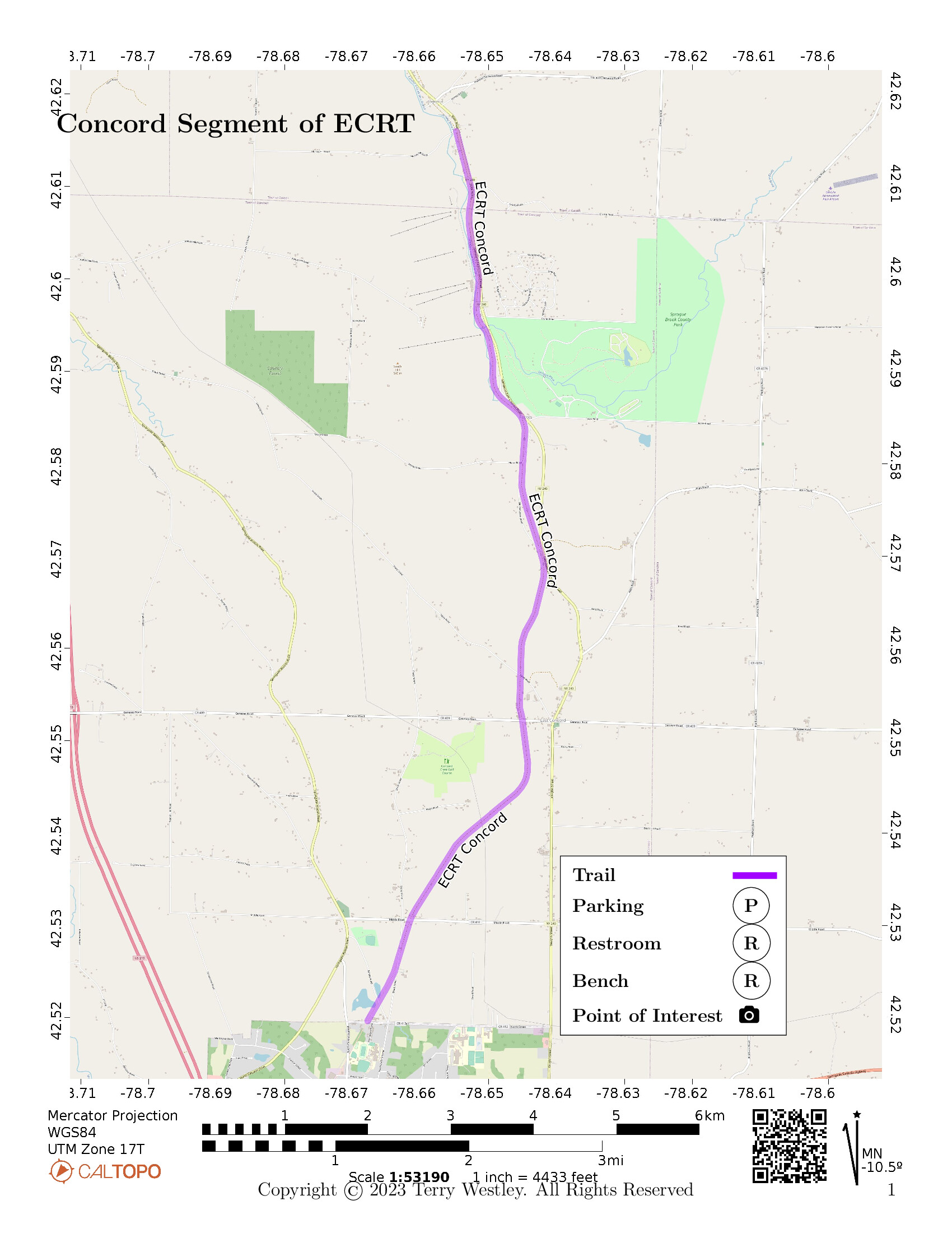
The Concord Segment of the Erie Cattaraugus Rail Trail (ECRT)![]() is a 7.4 mile rail trail near Concord, Erie County, NY.
The northern trailhead is on Murray Hill Road just off the intersection with State Road (NY-240) in Glenwood, NY.
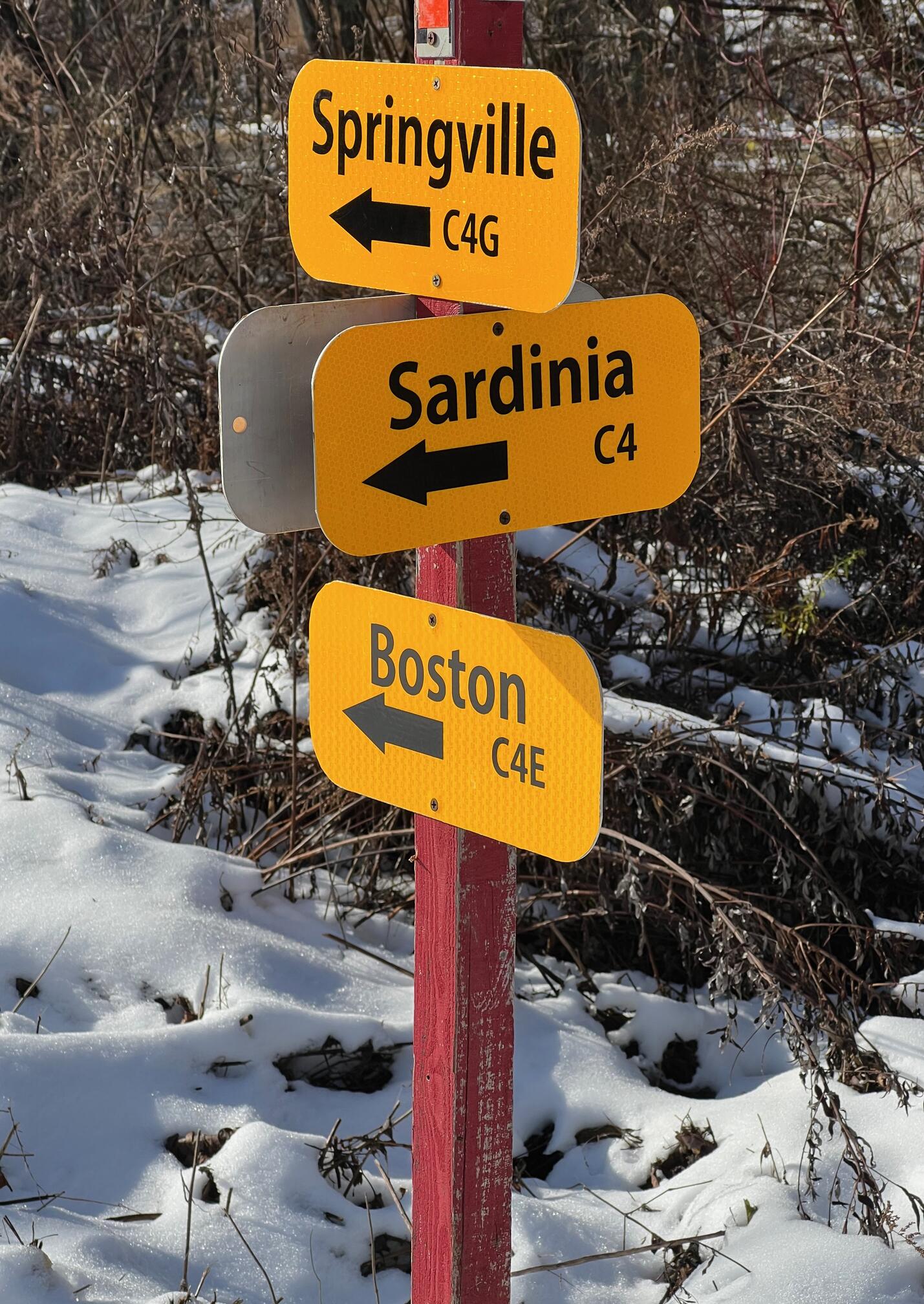
The southern trailhead is on North Street (NY-412) in Springville, NY, where it meets the northern trailhead of the Springville Pop Warner Trail.
The total elevation gain is 295 feet.
is a 7.4 mile rail trail near Concord, Erie County, NY.
The northern trailhead is on Murray Hill Road just off the intersection with State Road (NY-240) in Glenwood, NY.
The southern trailhead is on North Street (NY-412) in Springville, NY, where it meets the northern trailhead of the Springville Pop Warner Trail.
The total elevation gain is 295 feet.
Leave No Trace, Ten Essentials
While you’re enjoying the outdoors, please leave no trace![]() to minimize your impact and preserve these special places for others to use as well. If you’re walking or hiking, please pack the REI ten essentials
to minimize your impact and preserve these special places for others to use as well. If you’re walking or hiking, please pack the REI ten essentials![]() for your own safety. When cycling, consider using this REI checklist
for your own safety. When cycling, consider using this REI checklist![]() . For other activities, review the hiking and biking essentials and use your judgement.
. For other activities, review the hiking and biking essentials and use your judgement.
Parking
There is no good parking at either trailhead. I found a nearby commercial outfit that gave me permission to park. Otherwise, you’re parking on the side of the road which is pretty narrow at both trailheads.
Trail Surface
The trail surface is grass, gravel, and mostly ballast (large gravel). There are some short easier sections but expect ballast for most of the way. That may exclude most wheelchairs, strollers, and rollerblades from this trail.
Near Springville, from Buffalo Road to North Street, the surface is very smooth, having been recently rolled with small crushed stone. I hope this is a portent for good things to come.
Please consider carefully whether this trail surface is adequate for your activity.
Restrooms
There are no public restrooms at the trailheads or along the trail.
Points of Interest
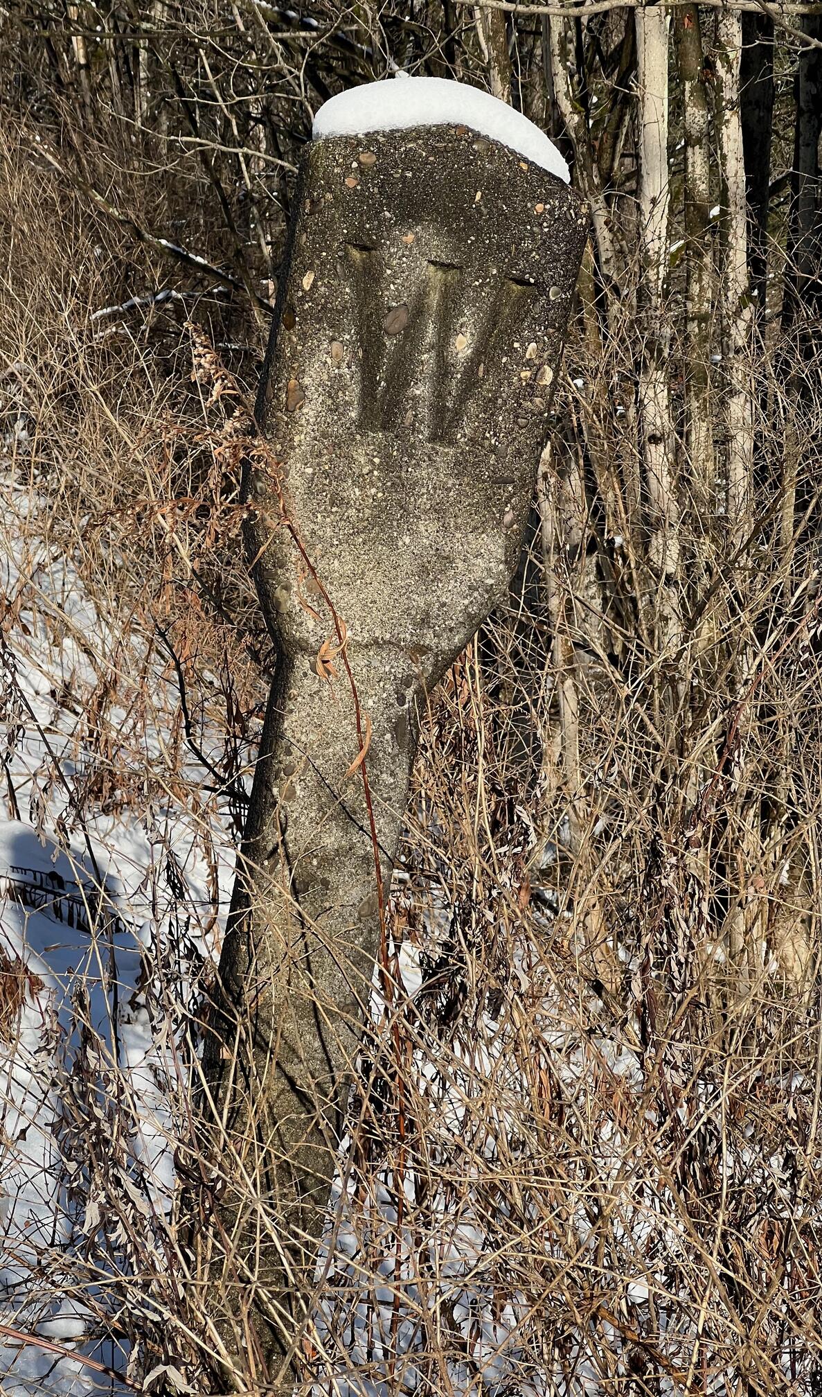
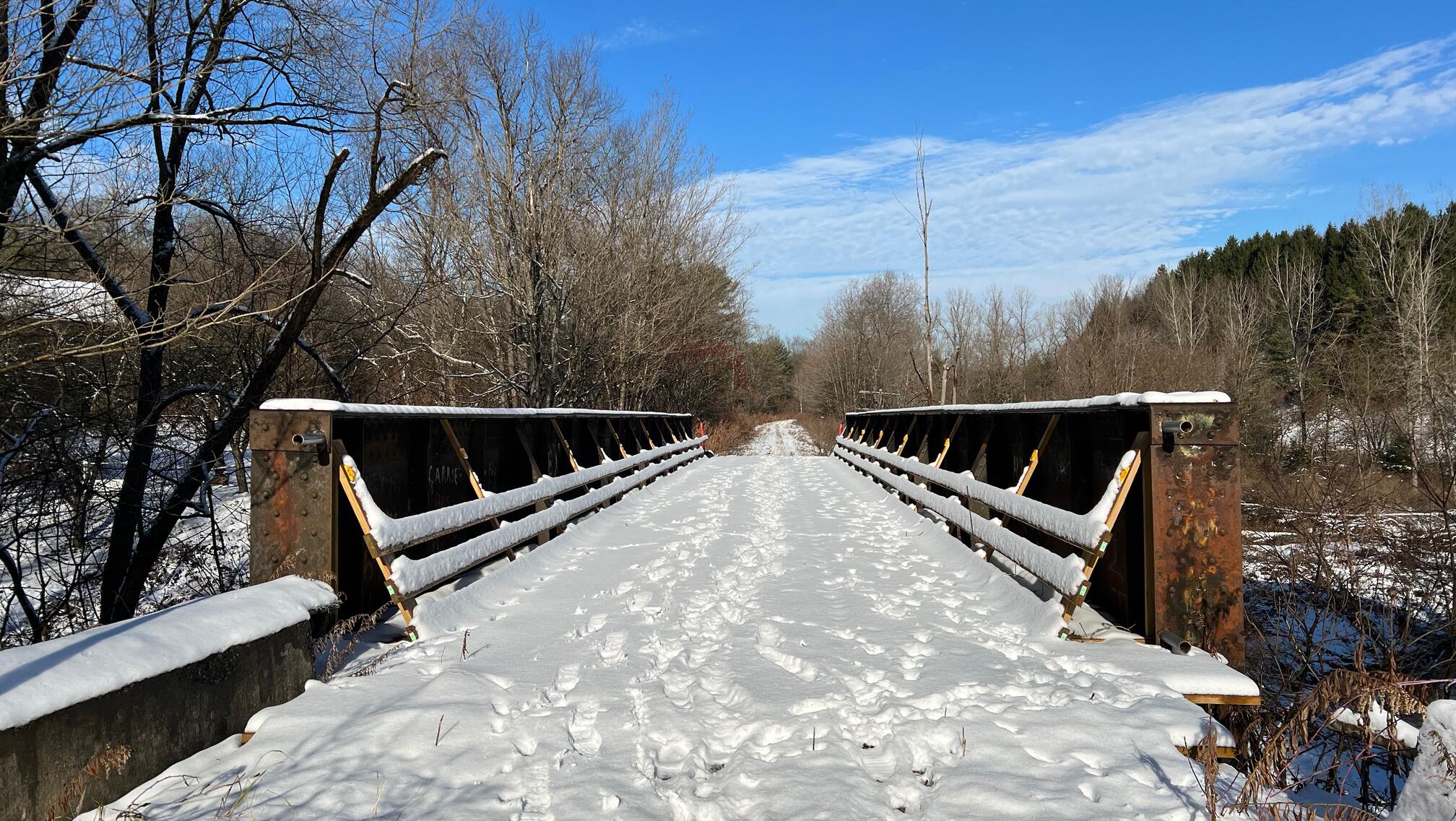
This is a lovely trail in a mixed forest of deciduous and evergreen. As you traverse it, you may be able to picture the train with cargo and passengers going between Buffalo and Pittsburgh. Some reminders of this are where the railbed was built up through the many valleys and several concrete markers.
After a snowfall, you will see many tracks on the trail including deer, rabbits, birds, dogs, and humans.
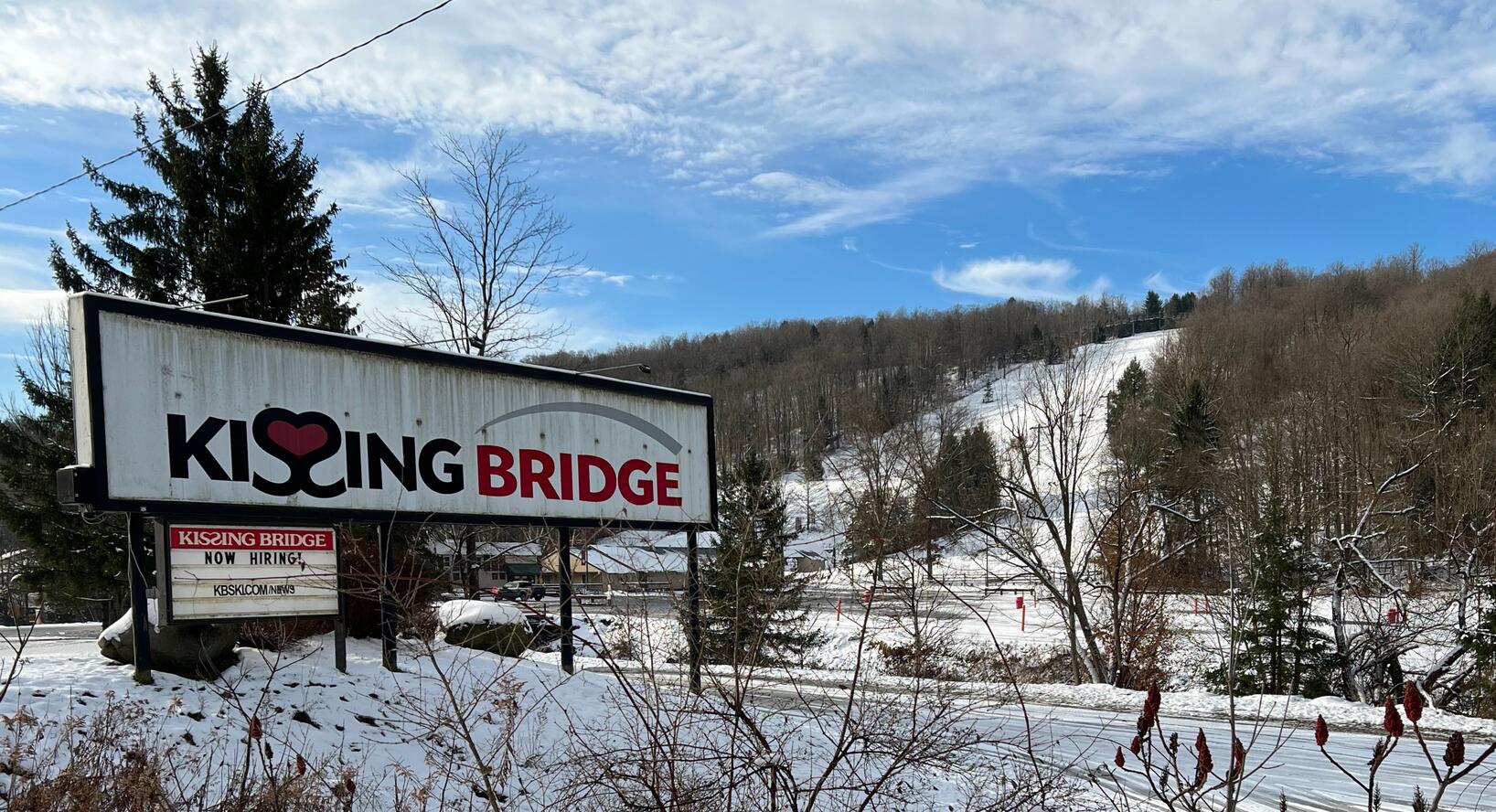
At the north end of the trail, you pass by several Kissing Bridge slopes.
There are quite a few original railroad and trail bridges along the way.
The trail is shared with snowmobilers in the winter. Their trail signs are abundant. In an introduction to the ECRT, a trail sign at Buffalo Road says,
Walking, hiking, cycling, cross-country skiing and snowshoeing are permitted on all open sections. Surface-friendly biking is available in Orchard Park and Springville. Horseback riders are welcome in Concord and snowmobilers may use the Springville and open Concord sections of the trail when the local snowmobile trail system is open. ATVs, dirt bikes and other motorized vehicles are not permitted.
History
Adam Burns![]() writes on the
American-Rails blog
writes on the
American-Rails blog![]() :
:
If the Buffalo and Pittsburgh Railroad (reporting marks, BPRR) sounds familiar that is because its name is actually derived from the historic company that originally operated most of its lines, the Buffalo, Rochester & Pittsburgh.
The earliest history of this railroad can be traced back to the 1860s and it eventually grew into a moderate sized system serving western Pennsylvania and New York.
It became part of the Baltimore & Ohio in the 1930s and successor Chessie System/CSX decided to shed the property along with other traces of the B&O in 1988 creating the B&P, which instantly became a Class II, regional in the process.
Since then the B&P, now a part of the Genesee & Wyoming family, has continued to divest itself of low density lines.
From Parks & Trails New York, September 4, 2018, “Erie Cattaraugus Rail Trail Scores Huge Win”![]() :
:
Western New York’s trail network got a major boost last month, when a 49-year railbanking agreement was signed to allow for the construction of the 27-mile Erie Cattaraugus Rail Trail southeast of Buffalo. Once complete, the trail will be the longest of its kind in the region.
The agreement, between the nonprofit Erie Cattaraugus Rail Trail, Inc. (ECRT), one of the groups to receive support from PTNY through our Healthy Trails, Healthy People program, and the Buffalo and Pittsburgh Railroad, owner of the line, will allow for the construction of the multi-use recreational trail. The agreement includes 50 years of renewal options. “We’re thrilled to have a signed agreement so we can start building the trail,” said Deborah Fenn, ECRT’s co-chair. “Our goals are to protect and maintain the trail as a natural, cultural and historic resource while providing a safe, welcoming place for people of all ages and abilities to enjoy nature and outdoor recreation.”
Hiking Solo (and Running, etc.)
Suppose you can do the whole point-to-point trail distance but not the out and back. If you don’t have multiple cars to stage at trailhead start and end, you might consider using Uber or Lyft to get a ride back to where you parked. Warning: this trail is in a less populated area and you may never get a driver. I got stranded at the Springville trailhead and could not get back to my car parked near the Concord trailhead. Thankfully, my wife was able to come and give me a ride.
Trail Summary
| Distance | 7.4 miles point to point | 14.8 miles out and back |
| Elevation gain | 295 feet | |
| Trail surface | Grass, gravel, and ballast | |
| Difficulty | Easy for point to point | Moderate for out and back |
| North Trailhead | 42.61596, -78.65474 |
|
| South Trailhead | 42.51947, -78.66787 |
Avenza Map
Avenza Map
- Load the PDF map into Avenza app on your smartphone in one of these ways:
- From your smartphone’s browser, tap this link to load the map directly into Avenza.
- From Avenza app’s Import Maps function, scan this QR code.

- Be sure to do this when you have good internet connection. Don’t wait until you are at the trailhead!
For more information about trail maps, see the Maps page.