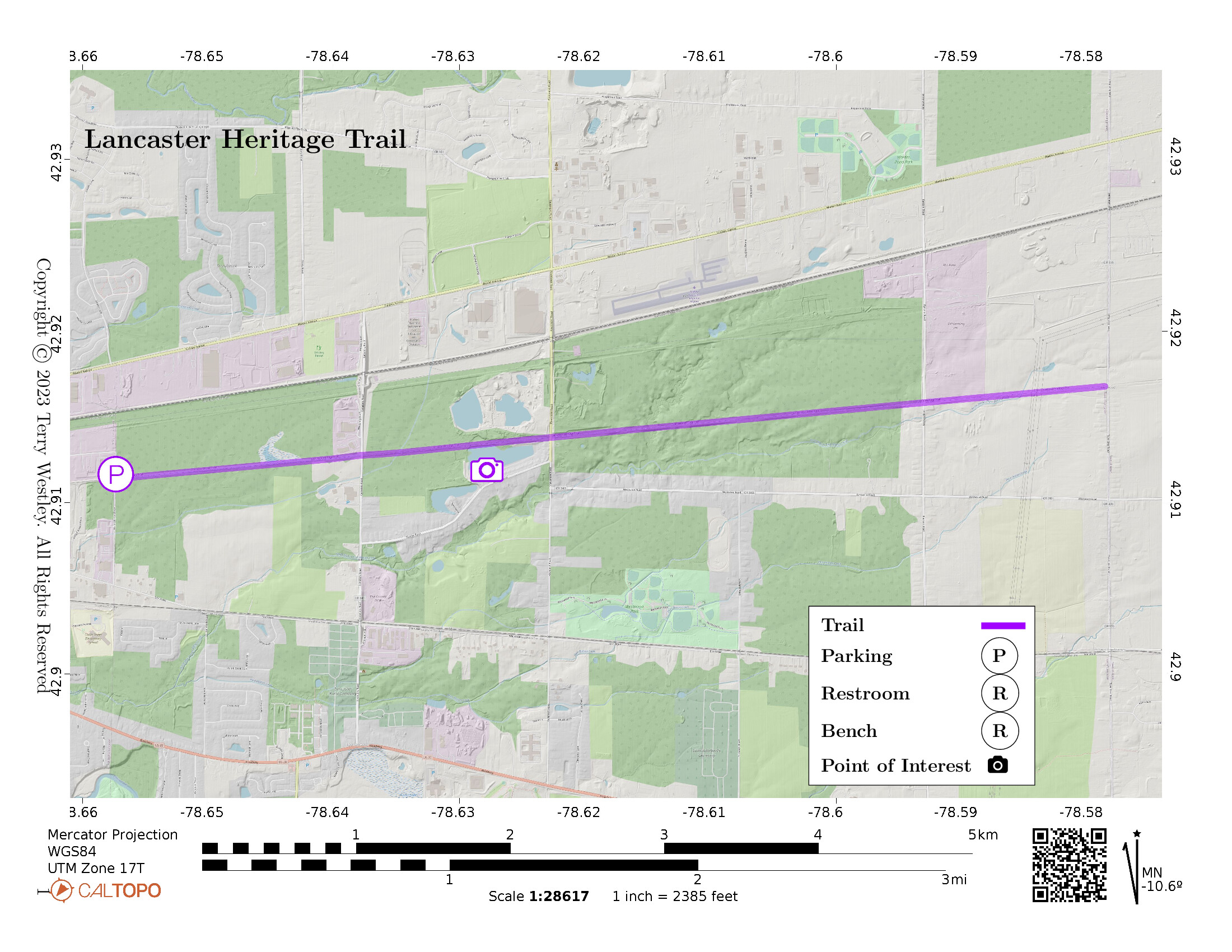
The Town of Lancaster Heritage Trail is an 8 foot wide, 4 mile point to point asphalt trail built on a Delaware, Lackawanna & Western Railroad bed. The western trailhead is on Walter Winter Drive and the eastern trailhead is on Townline Road. There are small parking lots at each trailhead.
The Town of Lancaster Parks and Rec department![]() warns that the trail is not open during fall hunting season (scroll down to Heritage Trail).
warns that the trail is not open during fall hunting season (scroll down to Heritage Trail).
The Town has an online map![]() you can print or view on your phone.
This map and a history lesson are displayed on a large sign at both trailheads.
you can print or view on your phone.
This map and a history lesson are displayed on a large sign at both trailheads.
Most of the trail is wooded and the woods are posted against trespassing.
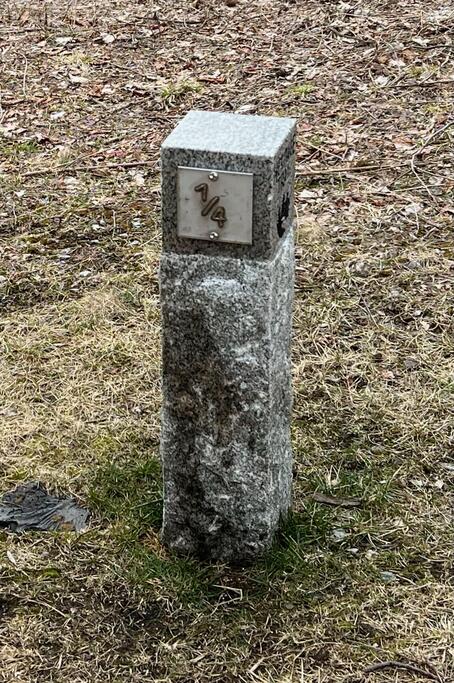
Trail distance markers are placed every ¼ mile starting from the Walter Winter trailhead. The first mile going east from Walter Winter trailhead has nice benches or rocks to stop and rest. They are pretty scarce the last three miles.
Leave No Trace, Ten Essentials
While you’re enjoying the outdoors, please leave no trace![]() to minimize your impact and preserve these special places for others to use as well. If you’re walking or hiking, please pack the REI ten essentials
to minimize your impact and preserve these special places for others to use as well. If you’re walking or hiking, please pack the REI ten essentials![]() for your own safety. When cycling, consider using this REI checklist
for your own safety. When cycling, consider using this REI checklist![]() . For other activities, review the hiking and biking essentials and use your judgement.
. For other activities, review the hiking and biking essentials and use your judgement.
Trail Surface
The trail is paved end to end and both parking lots are at grade level. There are intersections with streets at Cemetery Road, Pavement Road, and Ransom Road.
Please consider carefully whether this trail surface is adequate for your activity.
Restrooms
There are no public restrooms at the trailheads or along the trail.
Points of Interest
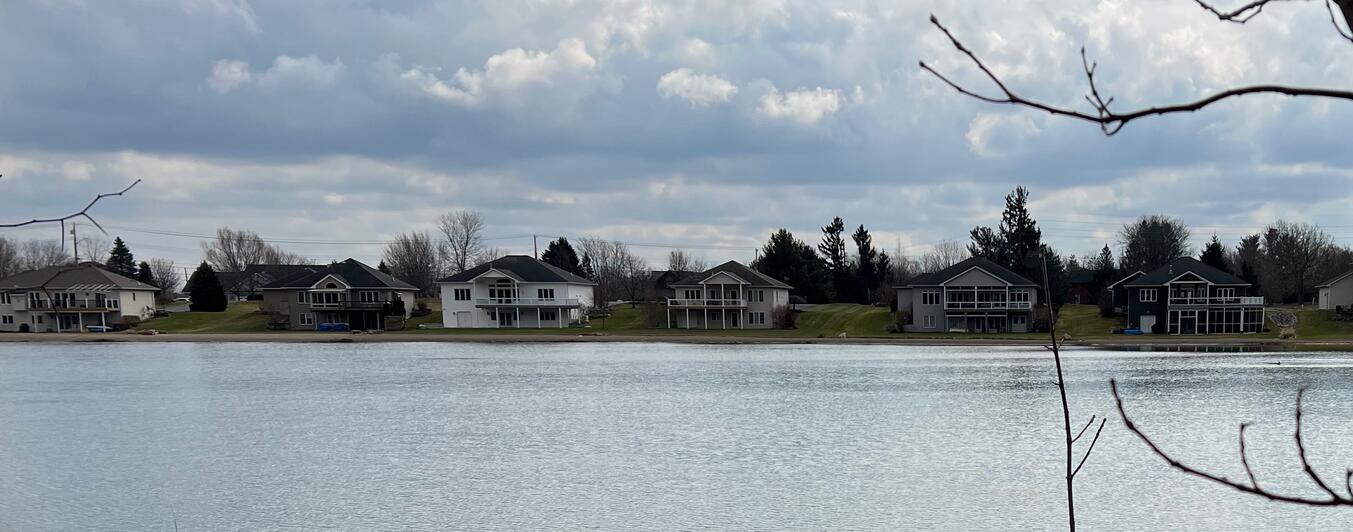
Between the trees, you can see some beautiful new homes on the south side of the trail across a small pond. Please do not trespass: these are private homes.
History
The town map describes some of the history of the trail:
This portion of the DL&W was built in 1882 to haul coal from mines in the Lackawanna Valley of Pennsylvania to steel mills near Buffalo. Additionally it hauled grain from Buffalo to the Port of New York. The railroad’s passenger service was renowned for fine service and picturesque views.
Massive wash outs near Elmira New York caused by Hurricane Diane in 1955 took more than than a month to repair. Soon after, air and highway competition forced the DL&W to merge with the parallel Erie Railroad in 1960. Operations on this segment of the line ceased after destruction of the Portageville viaduct by Hurricane Agnes in 1972.
The Town of Lancaster purchased this property in 1984. A federal grant aided construction of this bike path, opened in October 2010.
—History provided by Stanley Keysa
Hiking Solo (and Running, etc.)
Solo hikers who find themselves able to do the whole point-to-point trail distance but not the out and back may consider using Uber or Lyft to get a ride from where they parked to the other trailhead. Then you can walk to your car from there. Since this trail is in a populated area, you won’t have long to wait for a ride. I’ve done this several times (on other trails) because I usually hike solo.
Trail Summary
| Distance | 4 miles point to point | 8 miles out and back |
| Elevation gain | 81 feet | |
| Trail surface | Asphalt | |
| Difficulty | Easy | |
| Point of Interest | 42.91342, -78.62809 |
New homes across pond |
| Walter Winter Road Parking | 42.91166, -78.65733 |
13 spaces + 1 handicap, paved and striped |
Avenza Map
Avenza Map
- Load the PDF map into Avenza app on your smartphone in one of these ways:
- From your smartphone’s browser, tap this link to load the map directly into Avenza.
- From Avenza app’s Import Maps function, scan this QR code.

- Be sure to do this when you have good internet connection. Don’t wait until you are at the trailhead!
For more information about trail maps, see the Maps page.