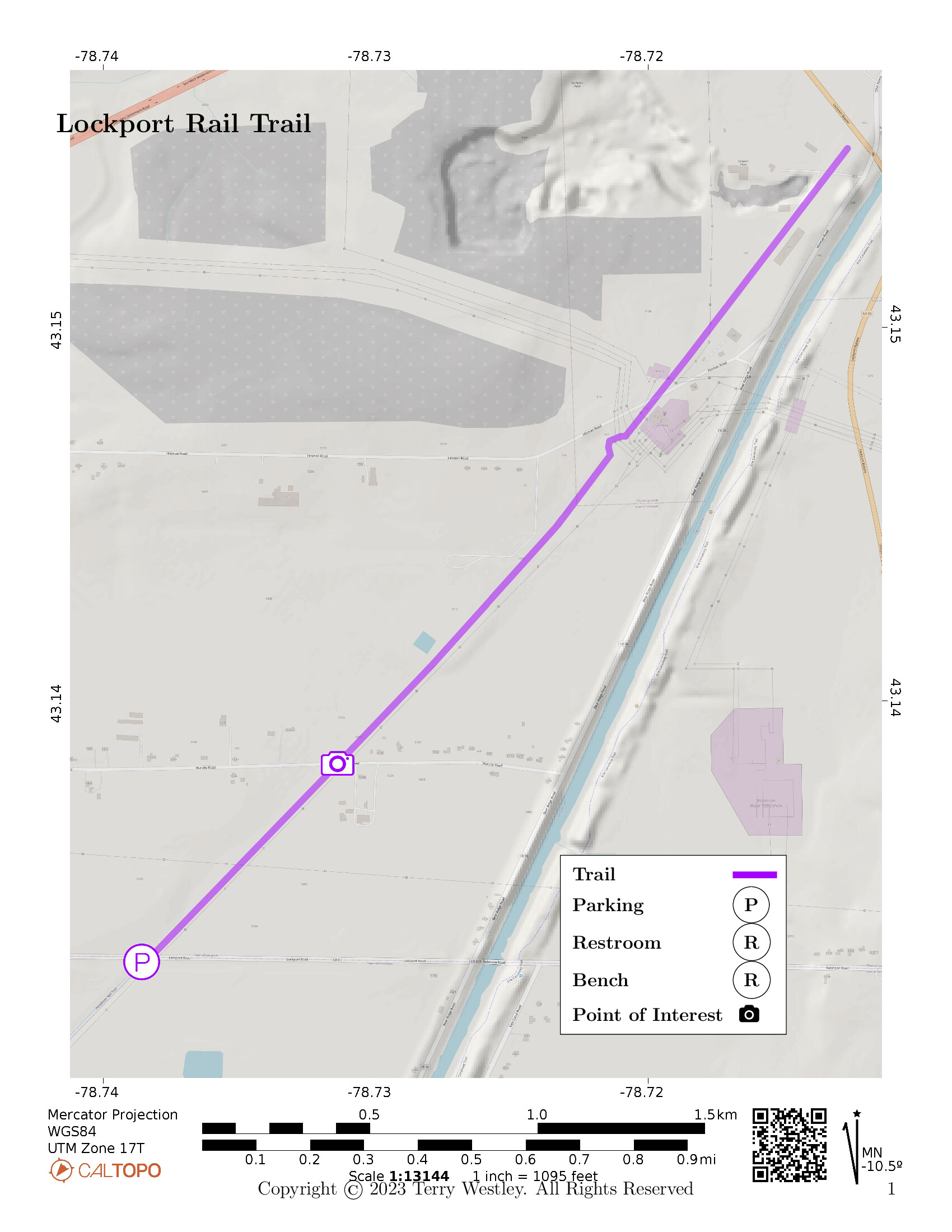
Starting at the southern trailhead on Lockport Road, the Lockport Rail Trail proceeds 2 miles via an Erie Railroad bed to its northern trailhead at Lockport Bypass near Hinman Road with elevation gain of 14 feet.
The parking lot at Lockport Road can hold 3-4 cars.
The southern trailhead at Lockport Road coincides with the northern trailhead of the .
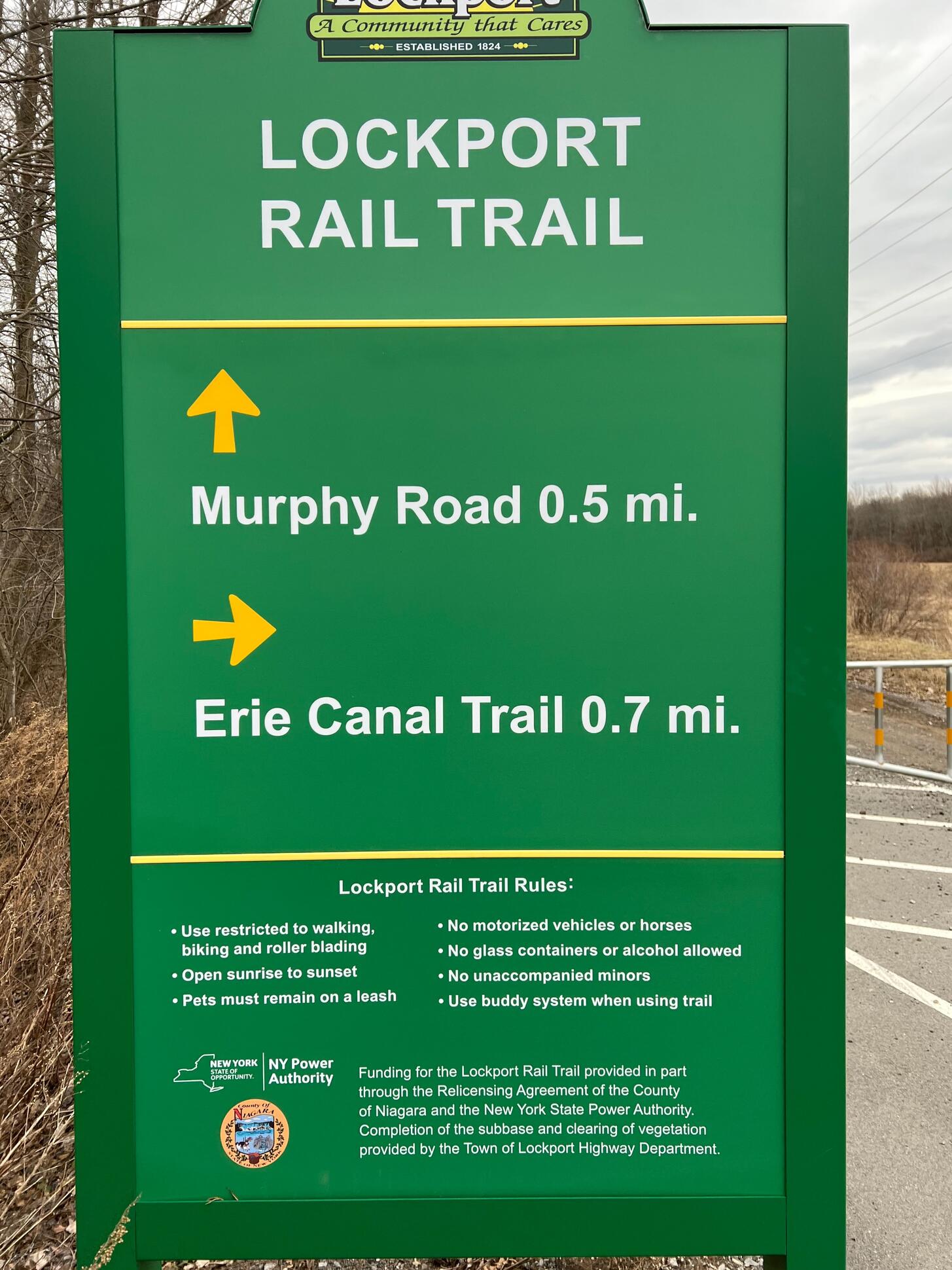
I don’t know if this sign means no e-bikes, but I’m sure they will accommodate strollers and wheelchairs.
Leave No Trace, Ten Essentials
While you’re enjoying the outdoors, please leave no trace![]() to minimize your impact and preserve these special places for others to use as well. If you’re walking or hiking, please pack the REI ten essentials
to minimize your impact and preserve these special places for others to use as well. If you’re walking or hiking, please pack the REI ten essentials![]() for your own safety. When cycling, consider using this REI checklist
for your own safety. When cycling, consider using this REI checklist![]() . For other activities, review the hiking and biking essentials and use your judgement.
. For other activities, review the hiking and biking essentials and use your judgement.
Trail Surface
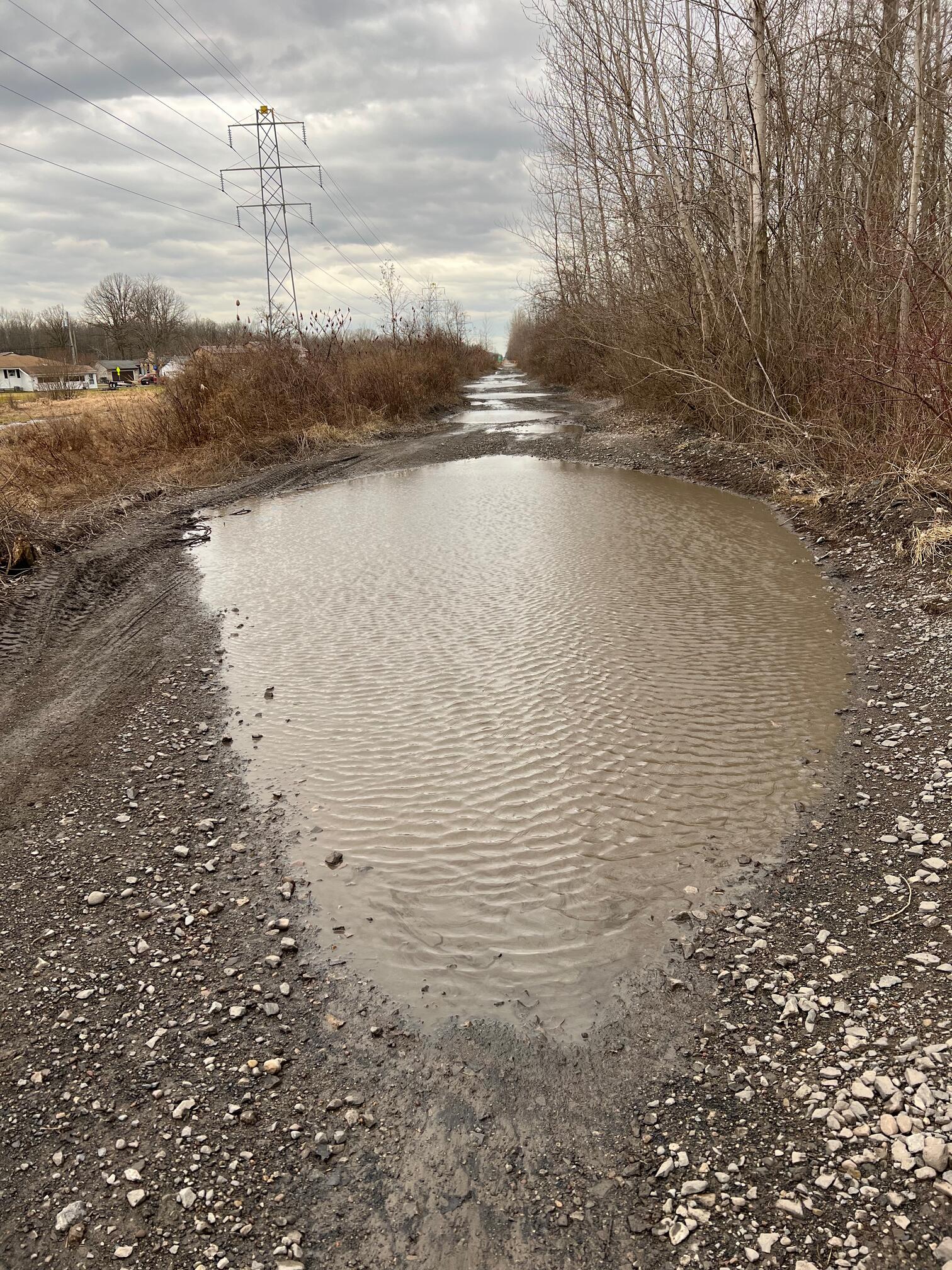
The first half mile starting from Lockport Road is a fairly new 8-foot wide asphalt path, likely suitable for roller blades, strollers and wheelchairs. North of Murphy Rd, however, the trail is undeveloped gravel and stone with big pools of water after heavy rains or snow melts.
Please consider carefully whether this trail surface is adequate for your activity.
Restrooms
There are no public restrooms at the trailheads or along the trail.
Points of Interest
Having no outstanding points of interest, I nominate the end of the paved trail at Murphy Road as a point of interest because that is where the improvement mentioned below in History section will start. Perhaps it has already started.
History
In a letter to President of the International Railway Company![]() , the General Counsel writes:
, the General Counsel writes:
It appears further that from January 27, 1902, the date of its organization, to April 1921? the International Railway Company conducted passenger and freight operations from Buffalo to North Tonawanda to Lockport to- Olcott and in the Cities of North Tonawanda and Lockport for the Erie Railroad Company pursuant to a “Lease-Agreement” dated June 1, 1898, and a supplemental “Lease” and “Contemporaneous Agreement” both dated September 1, 1899, between the Erie Railroad Company and the Buffalo & Lockport Railway, a predecessor of the International Railway Company.
Benjamin Joe writes in the February 23, 2023 edition![]() of the Lockport Union-Sun & Journal E-Paper.
of the Lockport Union-Sun & Journal E-Paper.
The Town of Lockport has received a grant of $168,591 from the New York State Office of Parks, Recreation and Historic Preservation to fund Phase Two of its Rail Trail project. The amount will be used to blacktop the former railroad track about 8-feet wide for pedestrian and non-motorized vehicle from Murphy Road to the City of Lockport line.
Hiking Solo (and Running, etc.)
Solo hikers who find themselves able to do the whole point-to-point trail distance but not the out and back may consider using Uber or Lyft to get a ride from where they parked to the other trailhead. Since this trail is in a less populated area, you may have to wait 15 minutes or more for a ride or you may not get a ride at all. I’ve done this several times because I usually hike solo.
Trail Summary
| Distance | 2 miles point to point | 4 miles out and back |
| Elevation gain | 14 feet | |
| Trail surface | Asphalt, gravel, stone, and pools of water | |
| Difficulty | Moderate | Due to condition of second half of the trail |
| Point of Interest | 43.13831, -78.73134 |
Murphy Road intersection |
| Lockport Road Parking | 43.13300, -78.73858 |
3-4 spaces, paved, not striped |
Avenza Map
Avenza Map
- Load the PDF map into Avenza app on your smartphone in one of these ways:
- From your smartphone’s browser, tap this link to load the map directly into Avenza.
- From Avenza app’s Import Maps function, scan this QR code.

- Be sure to do this when you have good internet connection. Don’t wait until you are at the trailhead!
For more information about trail maps, see the Maps page.