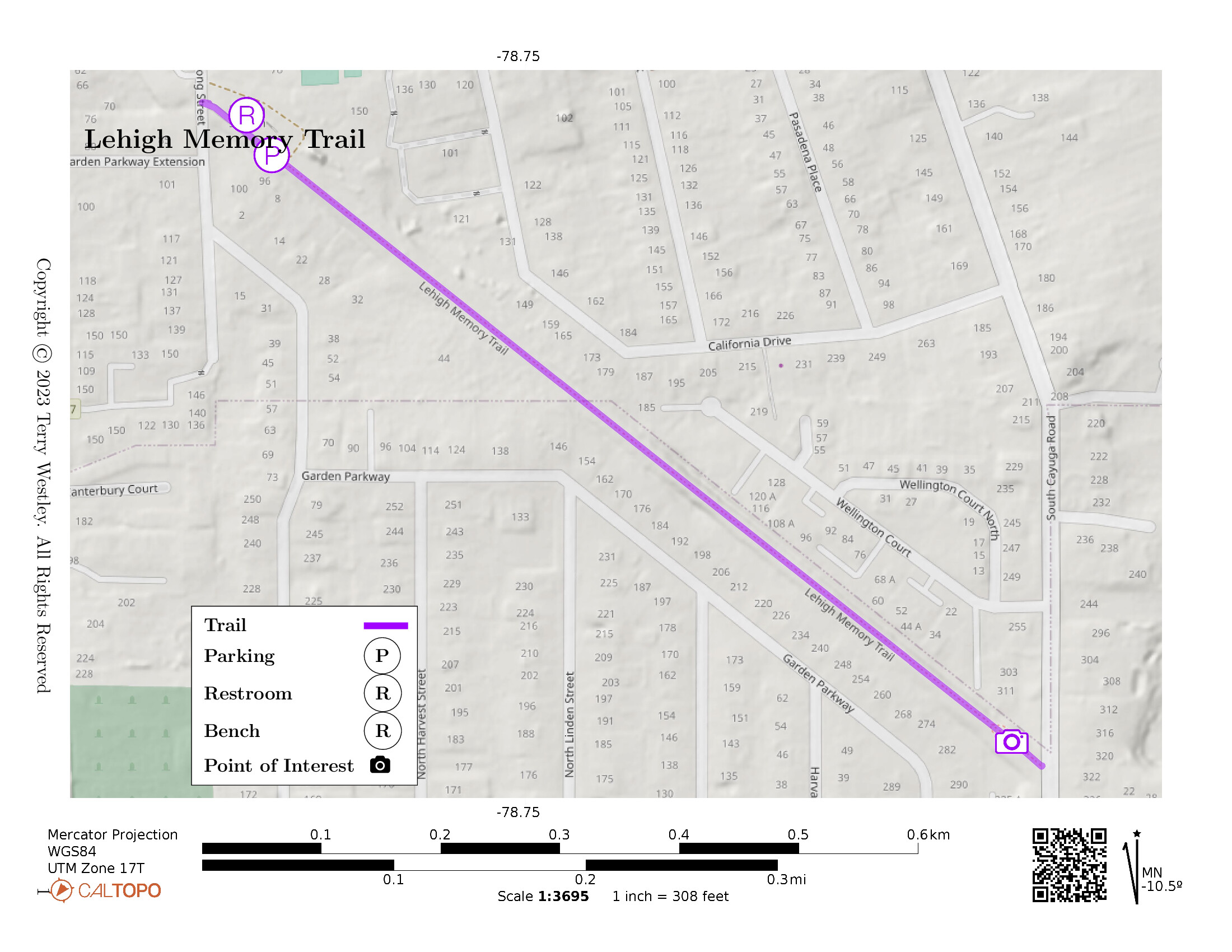
Lehigh Memory Trail is an 8-foot wide, 1/2 mile paved trail in the middle of a Williamsville, NY, residential area. The parking lot is just off South Long Street in the village. There are lovely benches along the way.
Leave No Trace, Ten Essentials
While you’re enjoying the outdoors, please leave no trace![]() to minimize your impact and preserve these special places for others to use as well. If you’re walking or hiking, please pack the REI ten essentials
to minimize your impact and preserve these special places for others to use as well. If you’re walking or hiking, please pack the REI ten essentials![]() for your own safety. When cycling, consider using this REI checklist
for your own safety. When cycling, consider using this REI checklist![]() . For other activities, review the hiking and biking essentials and use your judgement.
. For other activities, review the hiking and biking essentials and use your judgement.
Trail Surface
The trail is paved end to end, 8 to 10 feet wide. Some of the asphalt is cracked and heaved up just a bit so watch out for that.
Please consider carefully whether this trail surface is adequate for your activity.
Restrooms
There are no public restrooms at the trailheads or along the trail.
Points of Interest
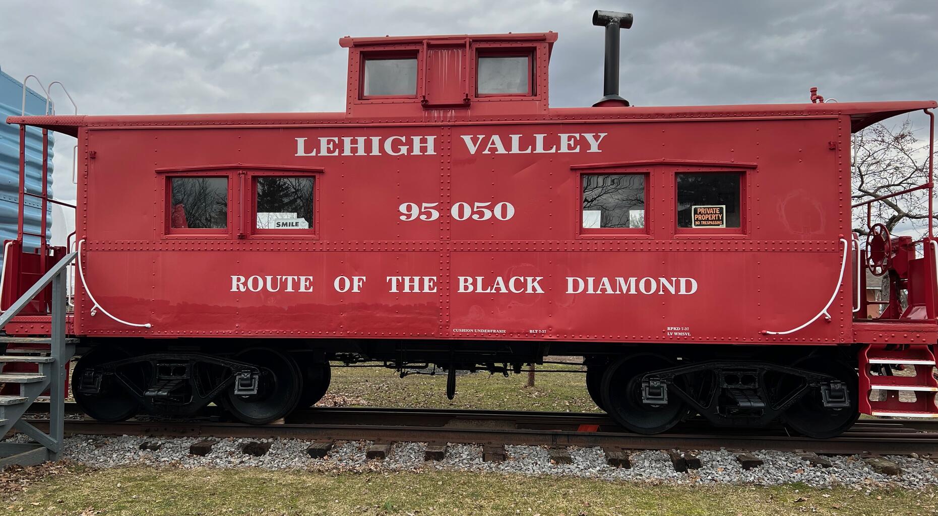
At the parking lot is the original Williamsville Depot along with a train engine and several cars, including a red caboose.
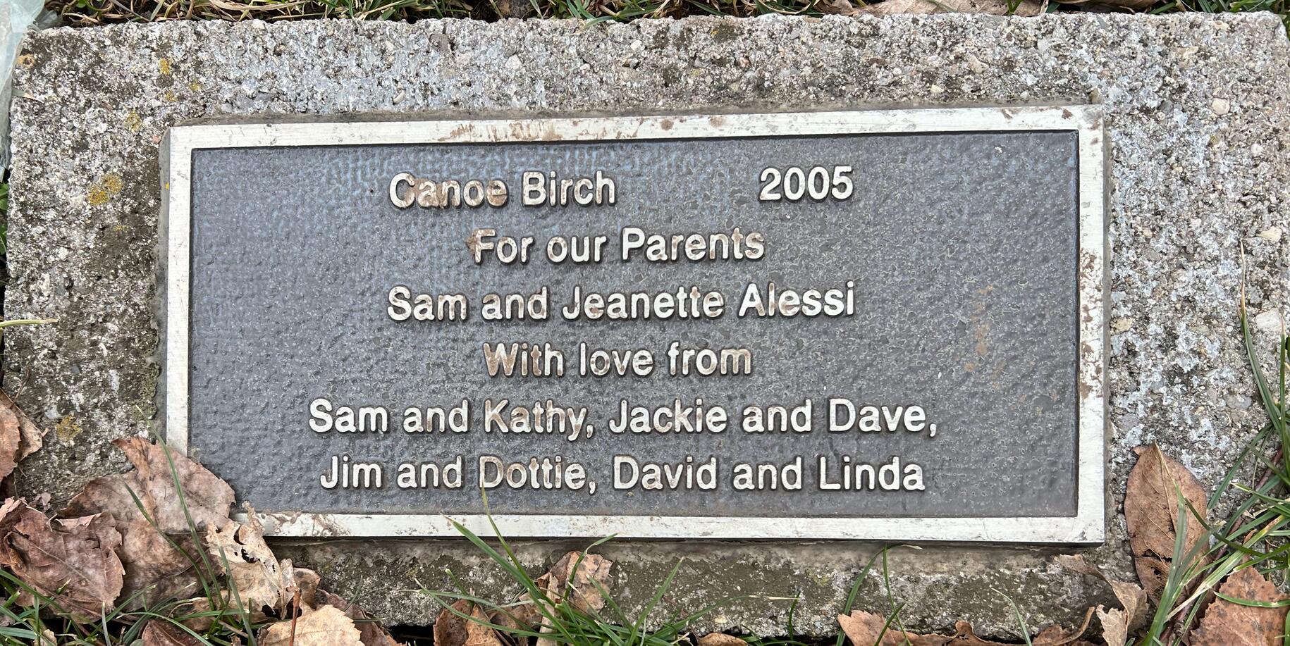
Other interesting sights along the way include town homes and a Canoe Birch tree dedicated to the memory of Sam and Jeanette Alessi.
History
In 1892, the Lehigh Valley Railroad completed its main line and established a western terminus in Buffalo, New York. At the same time, Niagara Falls had begun to flourish as a tourist attraction. The LVRR, wanting to capitalize on the tourist appeal of the cataract and to extend its anthracite coal business to the Midwestern United States, entered an agreement with the New York Central to use the Central’s “Peanut Line” as its route to Niagara Falls. The “Peanut Line”, which began in Canandaigua, and ran through the towns of Clarence, Amherst, and Tonawanda, was used by the LVRR until November 14, 1896.
In 1895, officials of the Lehigh Valley Railroad felt that their line would get an economic boost from having its own Niagara Falls route. In the summer of 1895, ground was broken on a 10.5 mile branch line that would bypass Buffalo at Depew, connect with the “Peanut Line” in Tonawanda, and take the LVRR into Niagara Falls, New York, Canada, and the Midwestern U.S. The new branch of the LVRR opened on November 15, 1896 and was made a subsidiary of its parent company. It was called “The Depew and Tonawanda Railroad.”
The village of Williamsville, New York, a suburb of Buffalo in the town of Amherst, was at the mid - point of the Depew and Tonawanda Railroad. In October of 1896, at a site on South Long Street in Williamsville, construction began on a railroad station designated to monitor passenger and freight business in the town of Amherst.
This depot was erected in approximately four weeks from what may have been a prefabricated kit. The Williamsville station was open for business when the Depew and Tonawanda began operations on November 15, 1896. It should be noted that in its earliest years, this countryside railroad depot was characterized by beautiful stained glass windows in its dormers, and a passenger platform on its south side.
Trail Summary
| Distance | 0.5 miles point to point | 1 mile out and back |
| Elevation gain | 7 feet | |
| Trail surface | Asphalt | |
| Difficulty | Easy | |
| Point of Interest | 42.95430, -78.74504 |
Canoe Birch tree |
| South Long Street Parking | 42.958883, -78.75293 |
12-15 spaces, paved and striped |
Avenza Map
Avenza Map
- Load the PDF map into Avenza app on your smartphone in one of these ways:
- From your smartphone’s browser, tap this link to load the map directly into Avenza.
- From Avenza app’s Import Maps function, scan this QR code.

- Be sure to do this when you have good internet connection. Don’t wait until you are at the trailhead!
For more information about trail maps, see the Maps page.