The Mayville Village Trail is a segment of the Chautauqua Rails To Trails (CR2T)![]() .
The CR2T Trail Segments page
.
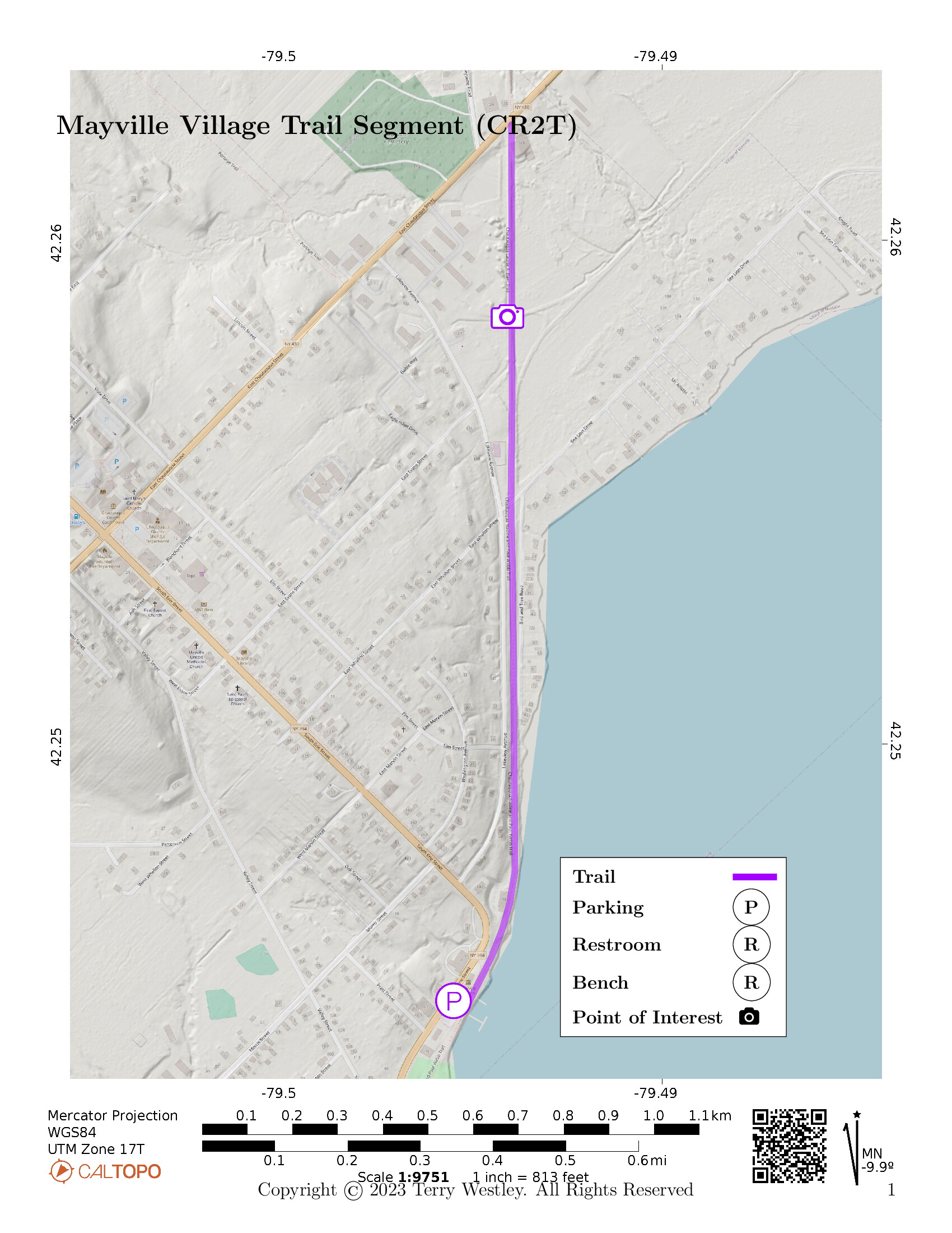
The CR2T Trail Segments page![]() says, the trail “runs from the lakefront area by State Route 394 to State Route 430 by the State Department of Transportation facility.”
The trail is 1.2 miles point to point (2.4 out and back) with an elevation gain of 26 feet.
says, the trail “runs from the lakefront area by State Route 394 to State Route 430 by the State Department of Transportation facility.”
The trail is 1.2 miles point to point (2.4 out and back) with an elevation gain of 26 feet.
Park near Mayville Depot or in Lakeside Park which is on the waterfront 0.26 miles south of Mayville Depot.
Besides our map below, see also CR2T’s map of the trail![]() .
.
Leave No Trace, Ten Essentials
While you’re enjoying the outdoors, please leave no trace![]() to minimize your impact and preserve these special places for others to use as well. If you’re walking or hiking, please pack the REI ten essentials
to minimize your impact and preserve these special places for others to use as well. If you’re walking or hiking, please pack the REI ten essentials![]() for your own safety. When cycling, consider using this REI checklist
for your own safety. When cycling, consider using this REI checklist![]() . For other activities, review the hiking and biking essentials and use your judgement.
. For other activities, review the hiking and biking essentials and use your judgement.
Trail Surface
The trail is completely paved and is wide. The asphalt is heaved up in many places near Chautauqua Rd. Many trees on both sides have been cut down but they are not on the trail. Perhaps this is to prevent further heaving.
Please consider carefully whether this trail surface is adequate for your activity.
Restrooms
There are public restrooms in Lakeside Park.
Points of Interest
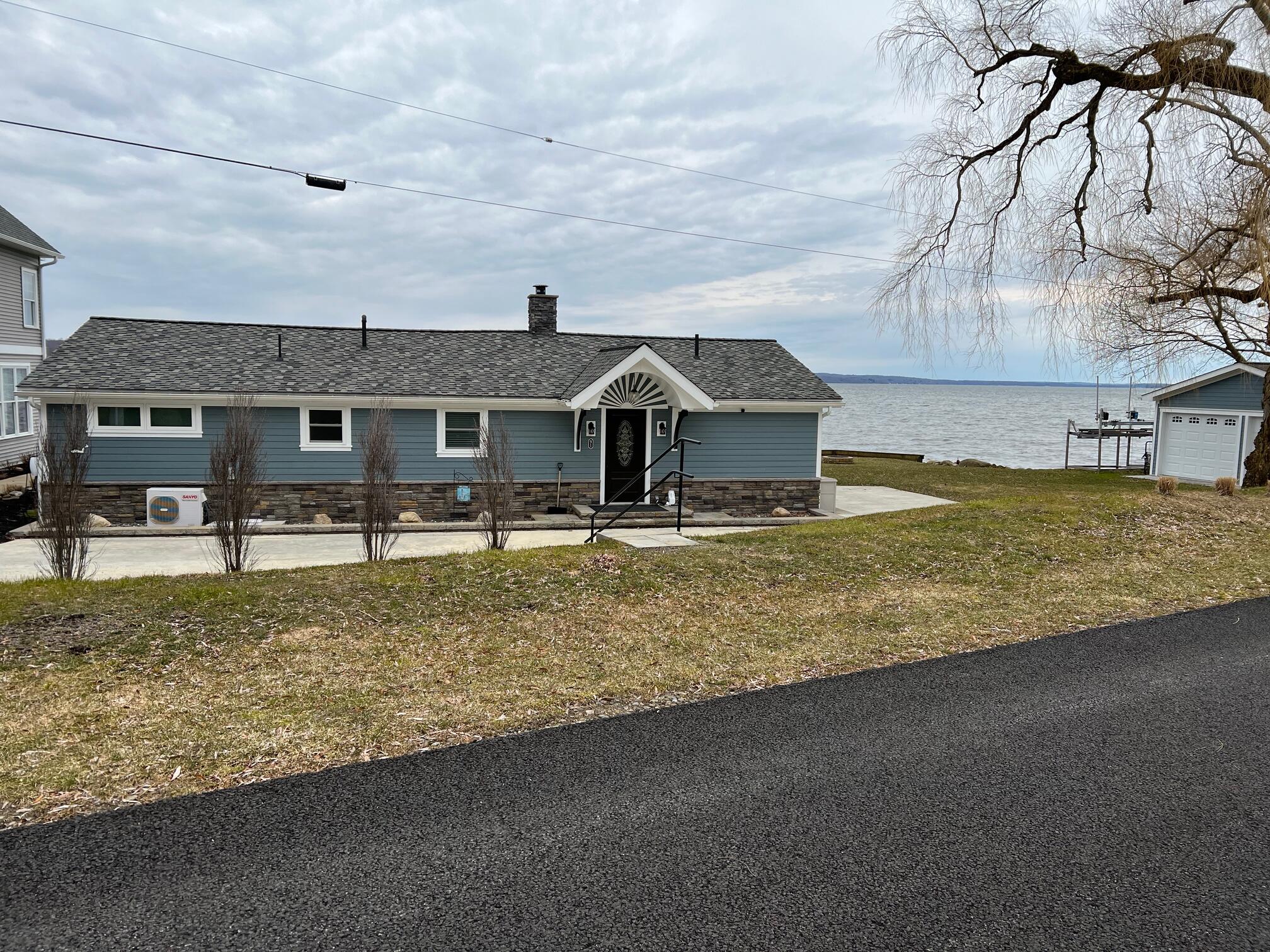
Enjoy great views of the north end of Chautauqua Lake, summer “cabins,” boat docks and launches.
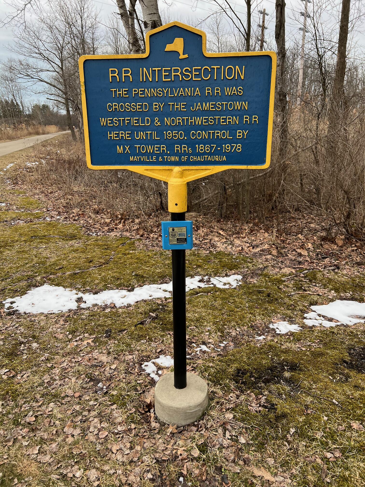
The historic intersection of Pennsylvania Railroad and Jamestown Westfield & Northwestern Railroad is also on this trail.
History
In A Brief History of Mayville![]() , Devon Taylor, Village of Mayville Historian, writes,
“The first railroad started operation in 1867.
It operated under several names including Penn Central and Conrail but was operated the longest, 1900 to 1968, as the
Pennsylvania RR.
The last train ran to Mayville on December 29, 1978 and the rails were torn up for salvage the following year.”
, Devon Taylor, Village of Mayville Historian, writes,
“The first railroad started operation in 1867.
It operated under several names including Penn Central and Conrail but was operated the longest, 1900 to 1968, as the
Pennsylvania RR.
The last train ran to Mayville on December 29, 1978 and the rails were torn up for salvage the following year.”
Eric Tichy writes in the October 13, 2021, edition The Jamestown Post-Journal![]() ,
“As its name suggests, Chautauqua Rails to Trails was first established in 1991 by converting abandoned railroad rights of ways into multipurpose recreational trails ideal for hikers, cyclists, snowmobiles and cross-country skiers.”
,
“As its name suggests, Chautauqua Rails to Trails was first established in 1991 by converting abandoned railroad rights of ways into multipurpose recreational trails ideal for hikers, cyclists, snowmobiles and cross-country skiers.”
Trail Summary
| Distance | 1.2 miles | 2.4 miles out and back |
| Elevation gain | 26 feet | |
| Trail surface | Asphalt | |
| Difficulty | Easy | |
| Point of Interest | 42.25848, -79.49414 |
Intersection of Pennsylvania RR and Jamestown Westfield & Northwestern RR |
| Mayville Depot Parking | 42.24489, -79.49565 |
Plenty of paved, striped parking |
Avenza Map
Avenza Map
- Load the PDF map into Avenza app on your smartphone in one of these ways:
- From your smartphone’s browser, tap this link to load the map directly into Avenza.
- From Avenza app’s Import Maps function, scan this QR code.

- Be sure to do this when you have good internet connection. Don’t wait until you are at the trailhead!
For more information about trail maps, see the Maps page.