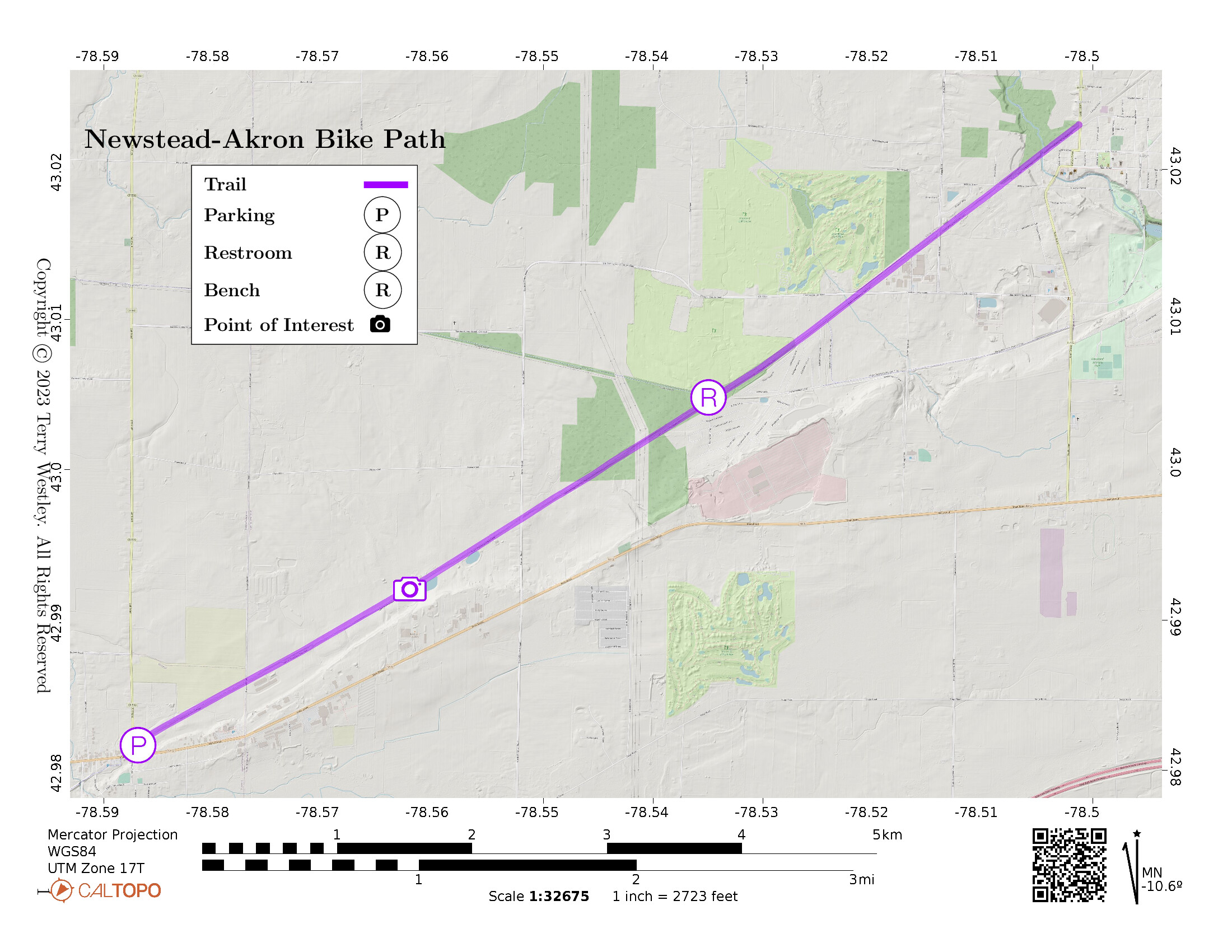
Variously called Newstead-Akron Bike Path, Akron-Newstead Bike Path, Town of Newstead Bike Path, Clarence Akron Pathway, and West Shore Line, this is a 5.2 mile fully paved rail trail. Do not confuse this with the West Shore Trail. This trail, Peanut Line Trail, Waterford Trail, and Spaulding Green Trail comprise the Clarence Pathways. In addition to Clarence, these trails go through Akron, Clarence Center, Lancaster, and East Amherst.
From Town of Newstead bike path information page![]() :
:
The Akron-Newstead bike path provides a safe, scenic setting for bicycles, rollerblading, walking and running. The path begins in the Village of Akron at the intersection of Cedar St (Rt. 93) and Eckerson Avenue. It runs approximately 4.6 miles southwest along the old Westshore railroad line and passes through Jackson St, Hake Rd, Clarence Center Rd, Barnum Rd, and Davison Rd, continuing on into Clarence to Salt Rd.
The trail in the map below includes a half mile section in the town of Clarence Hollow to reach the larger parking lot on Salt Rd.
You can also find a map![]() on the Newstead Town website.
on the Newstead Town website.
Leave No Trace, Ten Essentials
While you’re enjoying the outdoors, please leave no trace![]() to minimize your impact and preserve these special places for others to use as well. If you’re walking or hiking, please pack the REI ten essentials
to minimize your impact and preserve these special places for others to use as well. If you’re walking or hiking, please pack the REI ten essentials![]() for your own safety. When cycling, consider using this REI checklist
for your own safety. When cycling, consider using this REI checklist![]() . For other activities, review the hiking and biking essentials and use your judgement.
. For other activities, review the hiking and biking essentials and use your judgement.
Trail Surface
The trail is completely paved from start to finish. There are several intersections with streets but no curbs. The parking lot is a bit higher than the trail but there are no steps.
Restrooms
There is a portable toilet at the intersection
(43.00482, -78.53495![]() )
with the Amherst Peanut Trail.
)
with the Amherst Peanut Trail.
Points of Interest
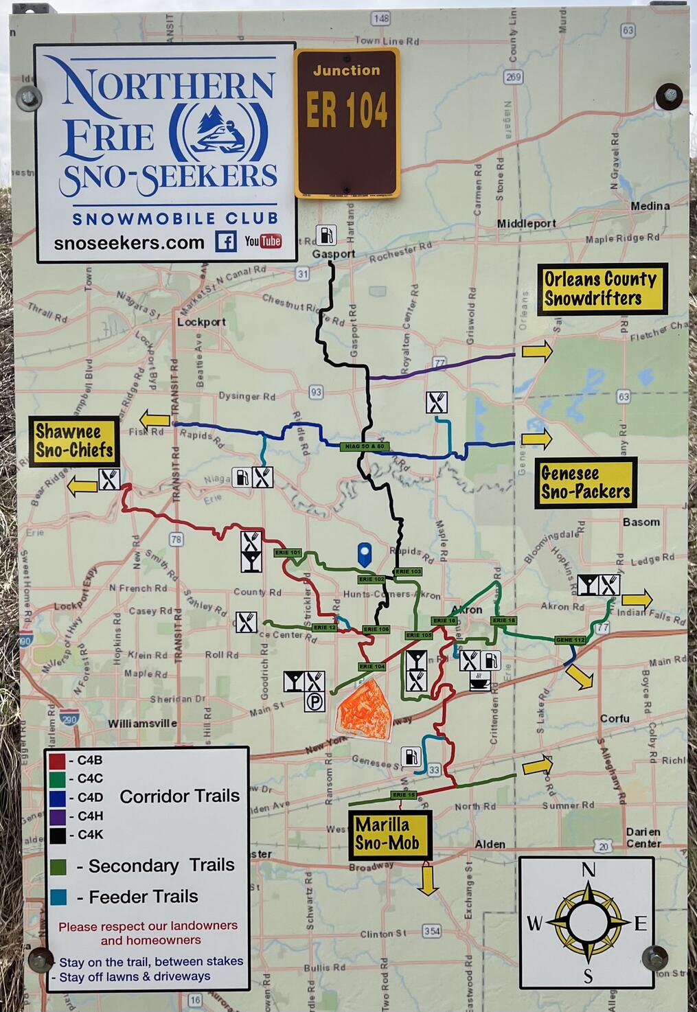
This map and photo may be of interest to snowmobilers.
I think the orange marker on the map signifies “you are here”
(42.99206, -78.56216![]() ).
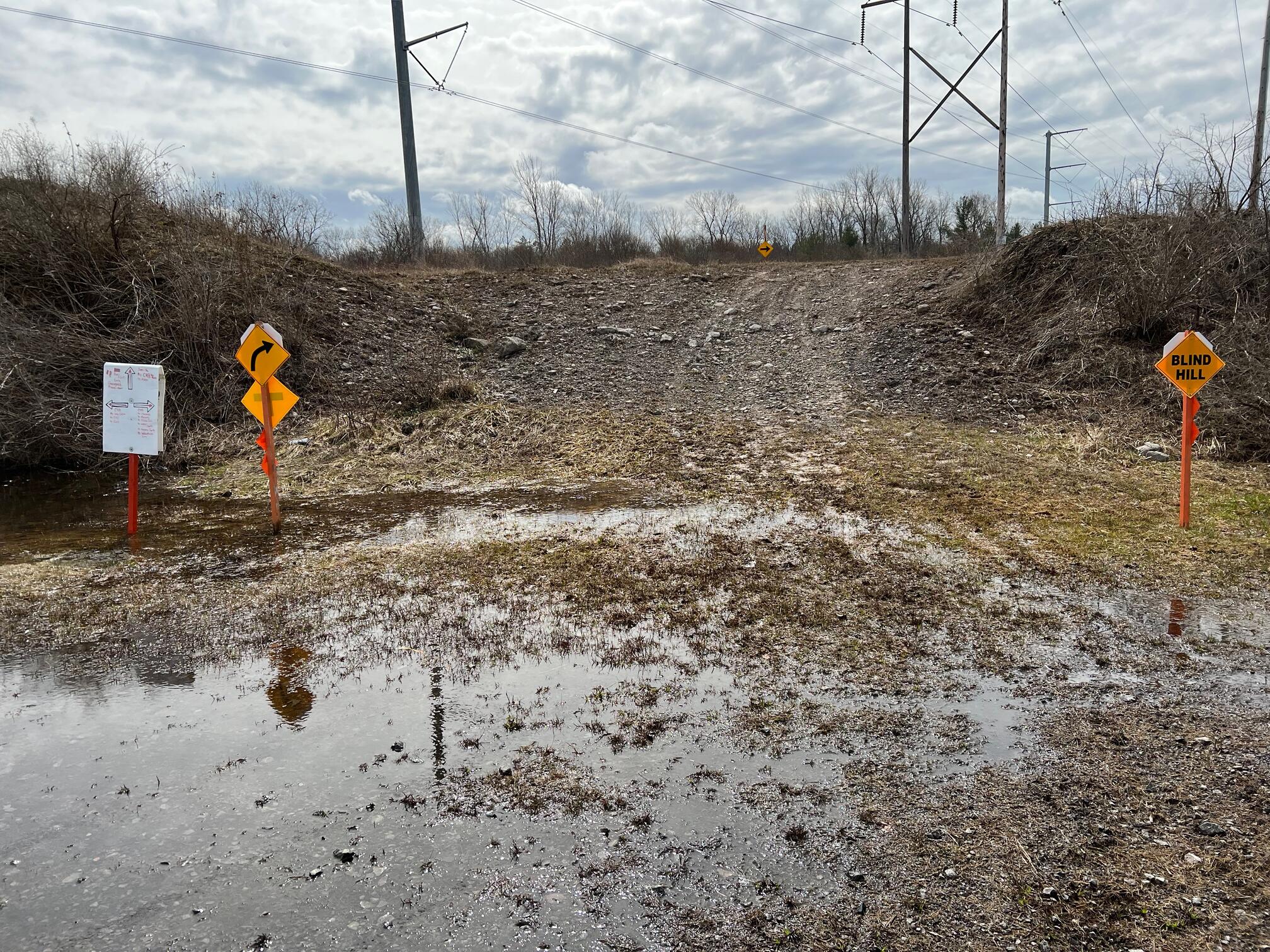
The photo is the snowmobile trail leaving the intersection with the Newstead-Akron Bike Path.
It looks better in the winter than after spring rains!
).
The photo is the snowmobile trail leaving the intersection with the Newstead-Akron Bike Path.
It looks better in the winter than after spring rains!
History
The trail follows a route of the West Shore Railroad. From Classic Trains:
In 1880 the New York, West Shore & Buffalo Railroad was formed to build a line from Jersey City to Albany and Buffalo, parallel to the New York Central. William Vanderbilt suspected (correctly) that the Pennsylvania Railroad was behind the project. The new road opened to Buffalo in 1884. A rate war ensued, bankrupting the West Shore.
It took J. P. Morgan to work a compromise between the NYC and the Pennsylvania: The Central would lease the West Shore, and the Pennsy would get the South Pennsylvania and its partially excavated tunnels. In 1885 the West Shore was reorganized as the West Shore Railroad, wholly owned by the NYC. …Most of the West Shore west of Albany has been abandoned.
Hiking Solo (and Running, etc.)
Solo hikers who find themselves able to do the whole point-to-point trail distance but not the out and back may consider using Uber or Lyft to get a ride from where they parked to the other trailhead. Since this trail is in a less populated area, you may have to wait 15 minutes or more for a ride or you may not get a ride at all. I’ve done this several times because I usually hike solo.
Trail Summary
| Distance | 5.2 miles point to point | 10.4 miles out and back |
| Elevation gain | 68 feet | |
| Trail surface | Asphalt | |
| Difficulty | Easy | |
| Point of Interest | 42.992058, -78.562163 |
Intersection with snowmobile trail |
| Salt Road Parking | 42.98165, -78.58688 |
24 spaces + 2 handicap |
Avenza Map
Avenza Map
- Load the PDF map into Avenza app on your smartphone in one of these ways:
- From your smartphone’s browser, tap this link to load the map directly into Avenza.
- From Avenza app’s Import Maps function, scan this QR code.

- Be sure to do this when you have good internet connection. Don’t wait until you are at the trailhead!
For more information about trail maps, see the Maps page.