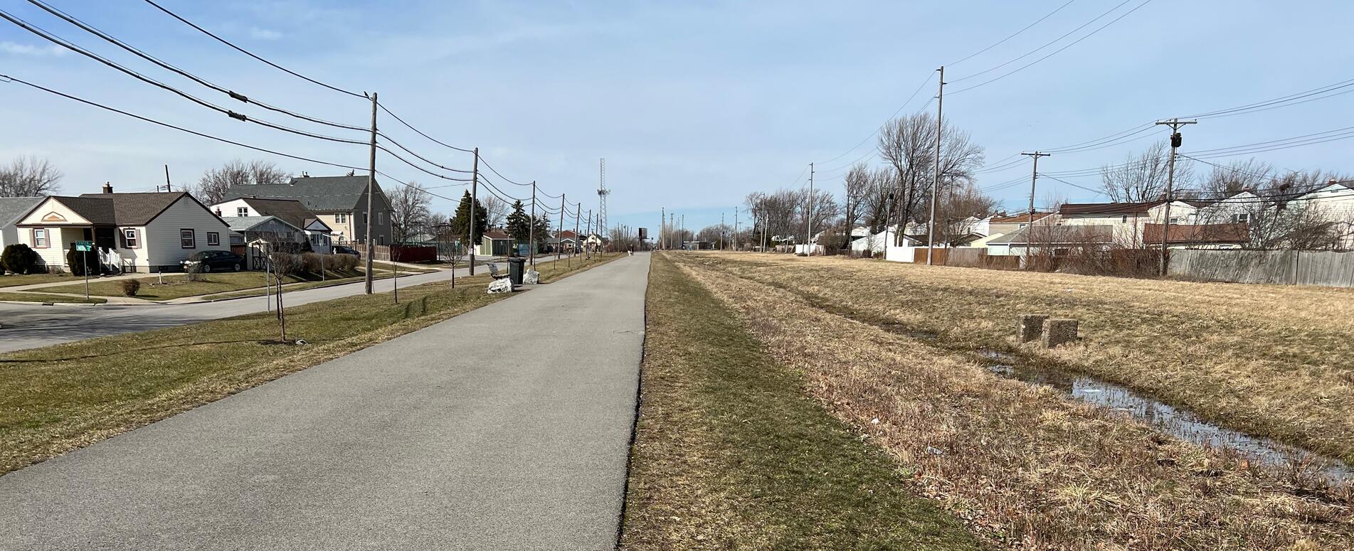
The North Buffalo Rails to Trails is a 0.8 mile point to point (1.6 miles out and back) trail in North Buffalo. It starts in Shoshone Park, proceeds through Minnesota Avenue Linear Park and then to Kenmore Ave. Shoshone Park parking lot is shared with ball game teams and spectators. The Kenmore Ave parking lot is dedicated to Tonawanda and North Buffalo Rails to Trails though much smaller than Shoshone Park lot.
Leave No Trace, Ten Essentials
While you’re enjoying the outdoors, please leave no trace![]() to minimize your impact and preserve these special places for others to use as well. If you’re walking or hiking, please pack the REI ten essentials
to minimize your impact and preserve these special places for others to use as well. If you’re walking or hiking, please pack the REI ten essentials![]() for your own safety. When cycling, consider using this REI checklist
for your own safety. When cycling, consider using this REI checklist![]() . For other activities, review the hiking and biking essentials and use your judgement.
. For other activities, review the hiking and biking essentials and use your judgement.
Trail Surface
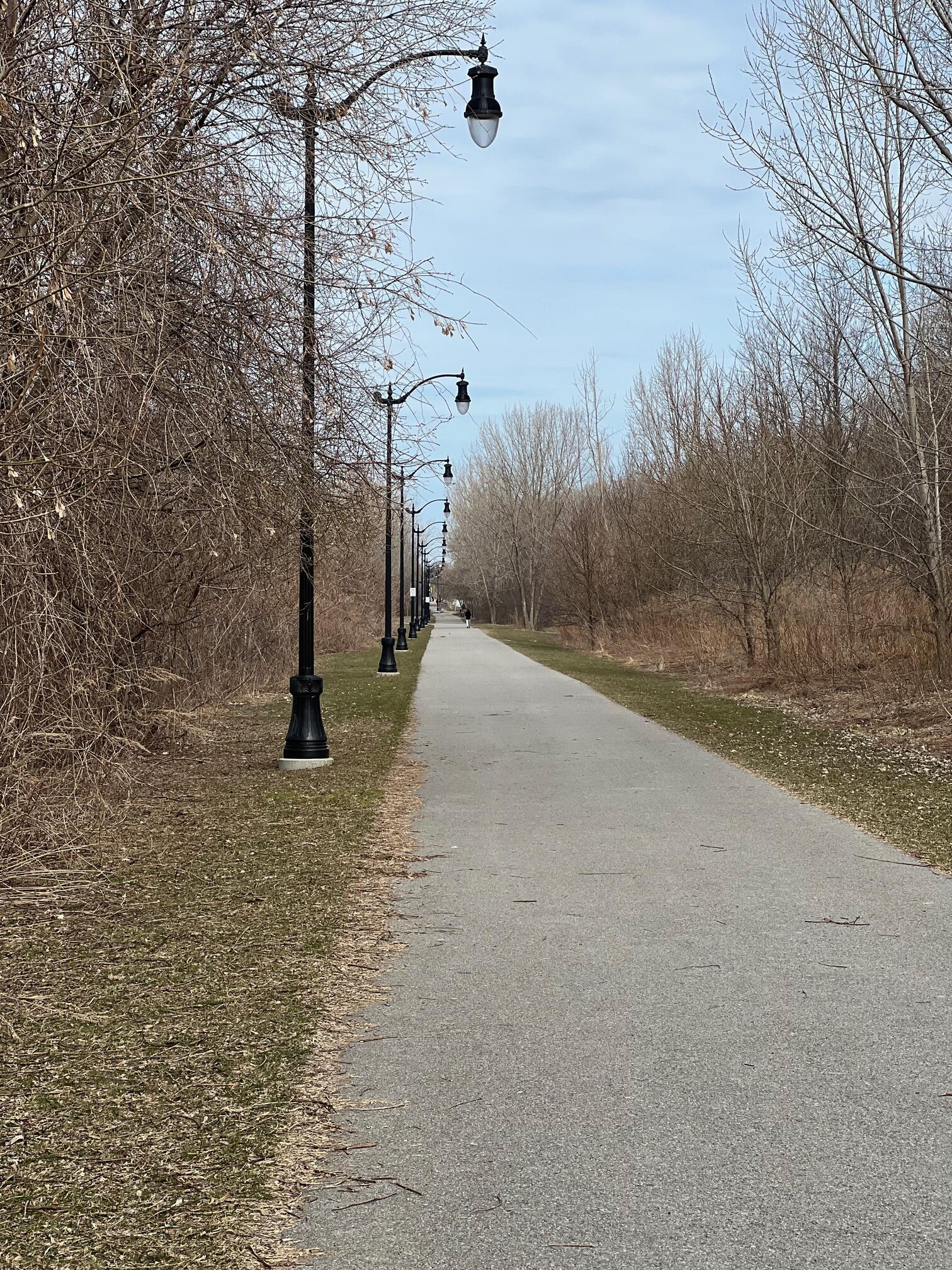
The trail is completely paved from Shoshone Park to Kenmore Ave. Its elevation is higher than Shoshone Park but there is access via a ramp. If you park at Kenmore Ave you have to cross the street to access the trail. There is a crosswalk and traffic light.
Restrooms
There are restrooms in Shoshone Park. I’m not sure whether they’re open 24/7.
Points of Interest
Shoshone Park is a large, popular park in North Buffalo.
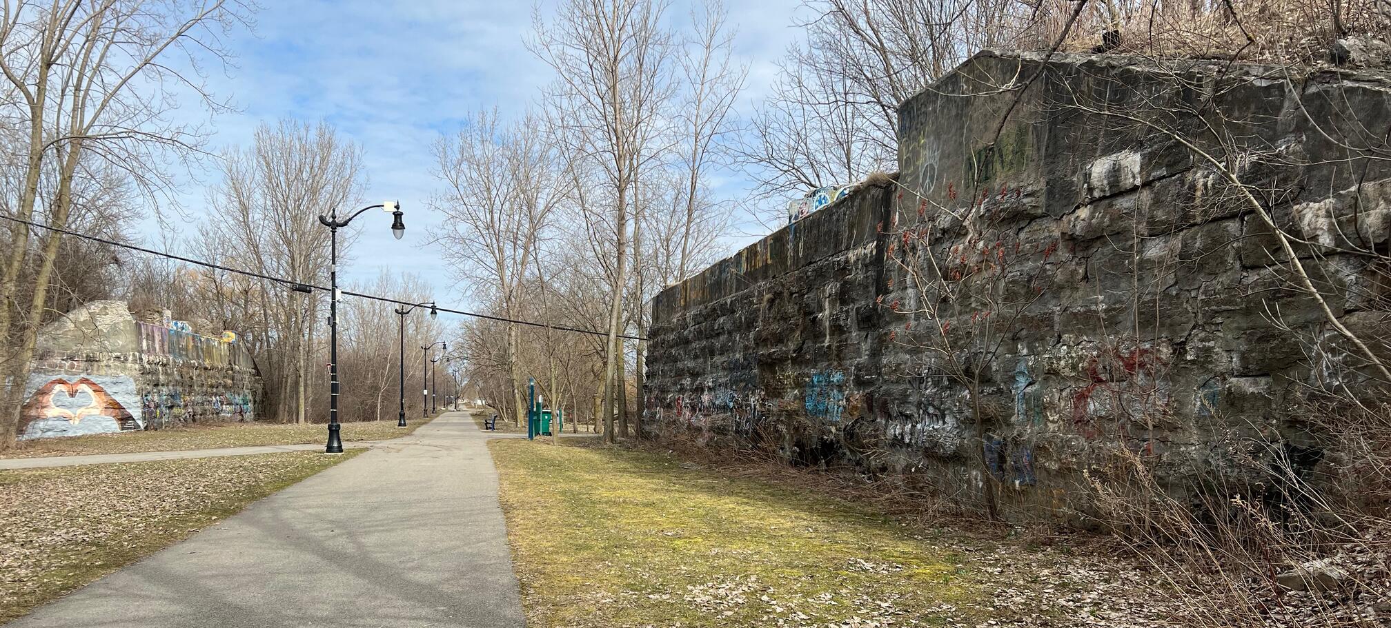
The trail goes right between a pair of railroad bridge abutments. The railroad that crossed overhead here was possibly the International Branch or Black Rock Branch of an unknown railroad.
History
A short history of the rail lines from a sign near the bridge abutments:
Following the First World War and shortly after the Second World War, Buffalo stood as the second largest railroad hub in the United States, second only to Chicago. More than a dozen railroads ran through the city, in which over 700 miles of track provided long distance passenger service and freight transportation. Despite the economic recession of the 1920’s and 1930’s, the railroad industry provided ample employment. However, during the mid-60’s the railroad industry across the United States failed to compete with the automobile advancements that followed the rise of the Interstate Highway System.
In Buffalo, movement by train began to decline significantly as traveling by automobile became more convenient and attractive mode of transportation. The rails also suffered from outmoded regulations as well as burdensome taxes. The once flourishing rail system withered further due to a mass exodus of downtown Buffalo residents moving to the suburbs.
In the railroad heyday, two main railroad lines ran through the current North Buffalo Rail Trail. They were the Erie Railroad and the Delaware, Lackawanna and Western (DL&W). In an effort to streamline operations, the Erie Railroad and DL&W Railroad were merged in 1960 to create the Erie Lackawanna Railroad (EL). Known as the Friendly Service Route, the EL was once recognized as, mile for mile, the most highly developed railroad in the US. The EL was later taken over by the Conrail in 1976.
NYS legislation passed in 1988, resulted in the sale of the right-of-way from Conrail to the NFTA. The North Buffalo Rail Trail was later completed in 2016 and is an extension of the Tonawanda Rail Trail located just outside of Buffalo’s city line.
Trail Summary
| Distance | 0.8 miles point to point | 1.6 miles out and back |
| Elevation gain | 36 feet | |
| Trail surface | Asphalt | |
| Difficulty | Easy | |
| Point of Interest | 42.95433, -78.83483 |
Railroad bridge abutments |
| Kenmore Ave Parking | 42.95865, -78.83729 |
6 spaces + 2 handicap, paved and striped |
| Shoshone Park Parking | 42.94769, -78.83224 |
Plenty + 2 handicap, paved and striped |
Avenza Map
Avenza Map
- Load the PDF map into Avenza app on your smartphone in one of these ways:
- From your smartphone’s browser, tap this link to load the map directly into Avenza.
- From Avenza app’s Import Maps function, scan this QR code.

- Be sure to do this when you have good internet connection. Don’t wait until you are at the trailhead!
For more information about trail maps, see the Maps page.