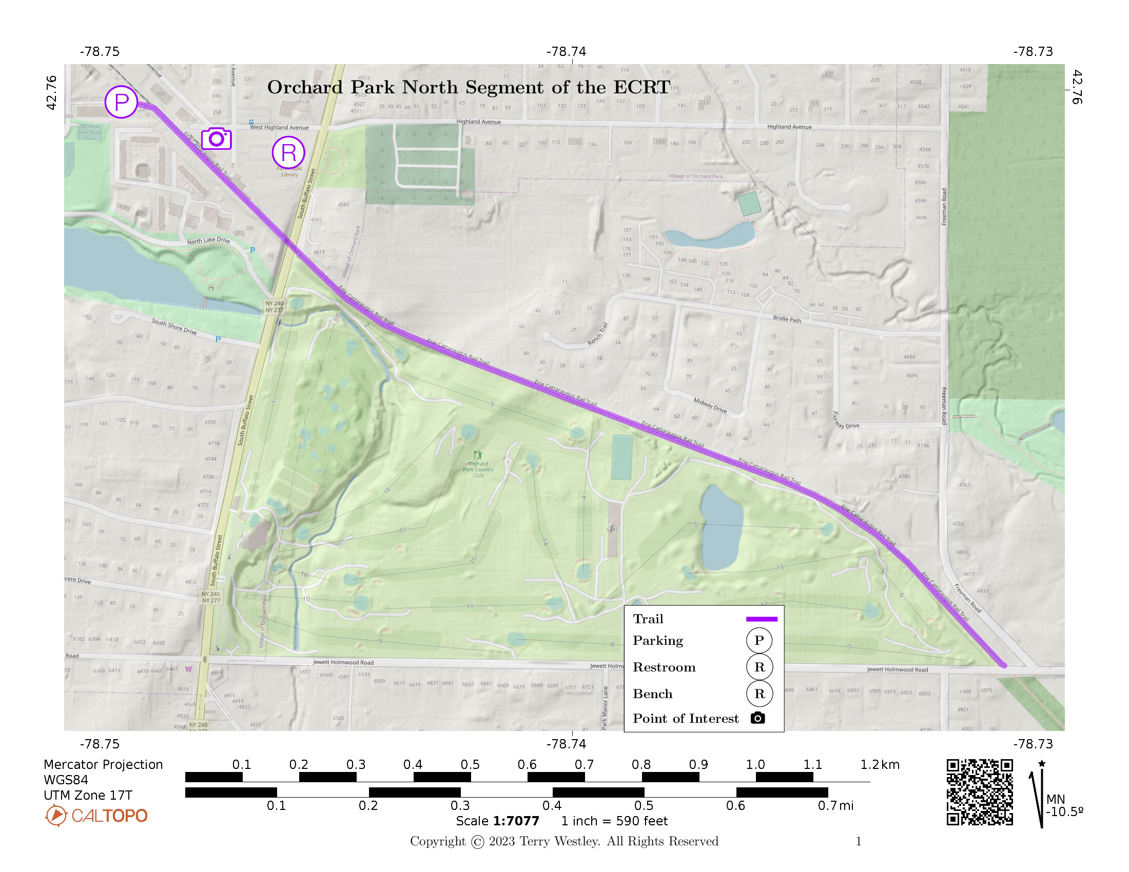
The Orchard Park North Segment of the Erie Cattaraugus Rail Trail (ECRT)![]() starts at its Bank Street trailhead and proceeds 1.2 miles through Orchard Park, NY, to its terminus on Jewett Holmwood Road.
Traversing from Bank Street to Jewett Holmwood, you will gain approximately 99 feet of elevation.
starts at its Bank Street trailhead and proceeds 1.2 miles through Orchard Park, NY, to its terminus on Jewett Holmwood Road.
Traversing from Bank Street to Jewett Holmwood, you will gain approximately 99 feet of elevation.
The trailhead has a small unpaved parking lot just off Bank Street in Orchard Park. There is no parking at Jewett Holmwood.
Leave No Trace, Ten Essentials
While you’re enjoying the outdoors, please leave no trace![]() to minimize your impact and preserve these special places for others to use as well. If you’re walking or hiking, please pack the REI ten essentials
to minimize your impact and preserve these special places for others to use as well. If you’re walking or hiking, please pack the REI ten essentials![]() for your own safety. When cycling, consider using this REI checklist
for your own safety. When cycling, consider using this REI checklist![]() . For other activities, review the hiking and biking essentials and use your judgement.
. For other activities, review the hiking and biking essentials and use your judgement.
Trail Surface
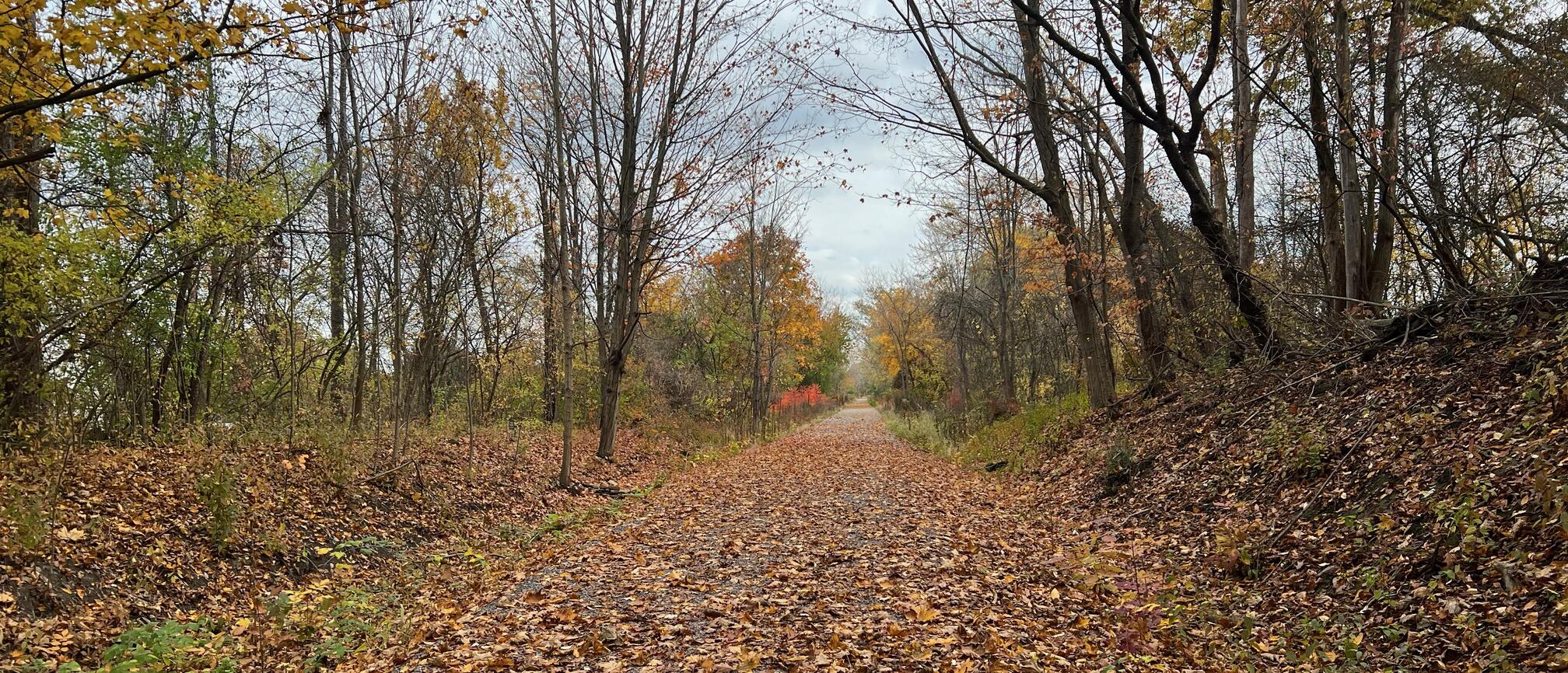
The trail surface is gravel end to end. It is easy to walk, bike, or roll.
Please consider carefully whether this trail surface is adequate for your activity.
Restrooms
There are no public restrooms at the trailheads or on the trail. There is a public library with restrooms near the Orchard Park Depot.
Points of Interest
Some points of interest along the trail include
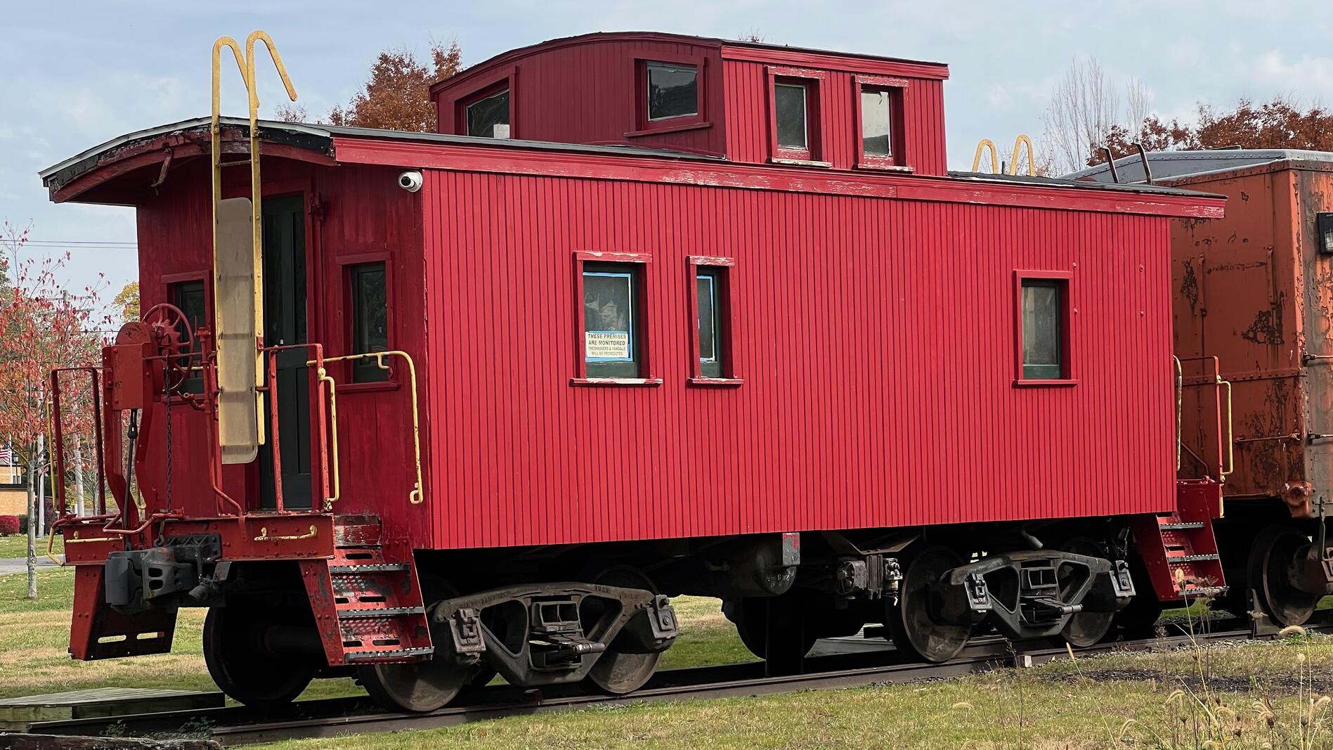
- several rail cars including a fine red caboose (see feature photo above),
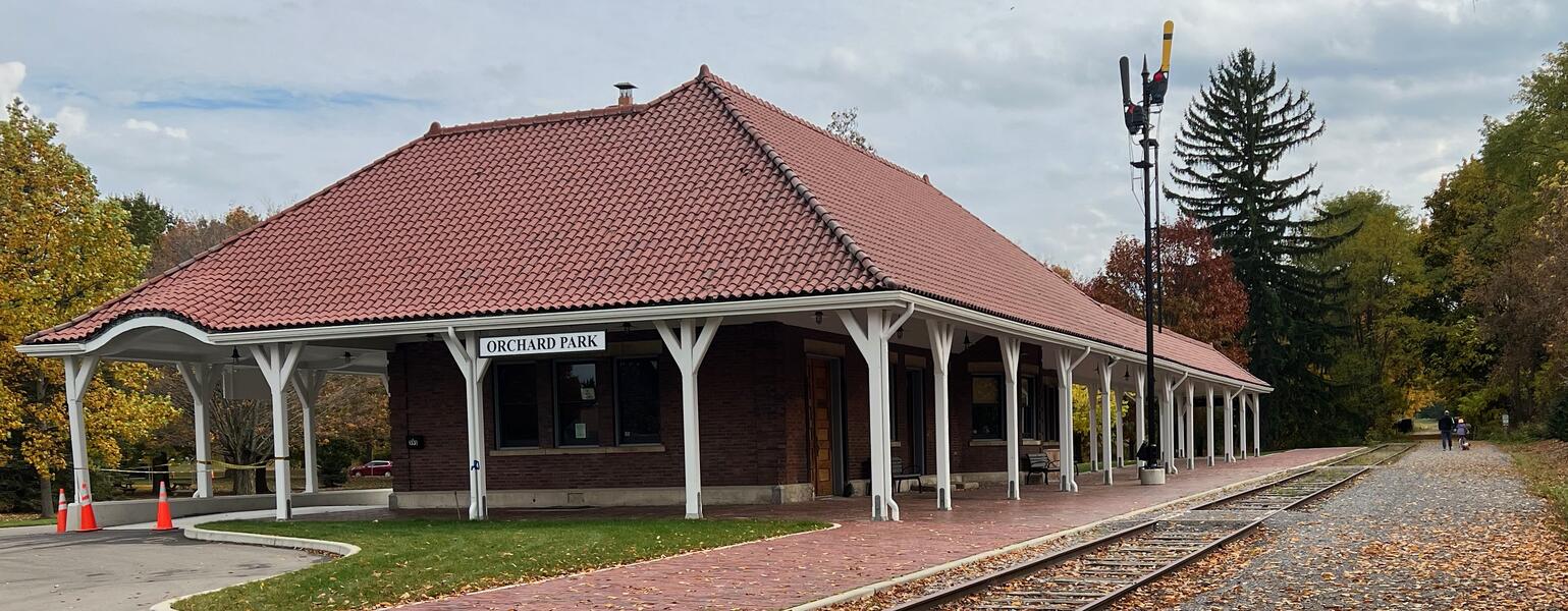
- Orchard Park Depot (closed),
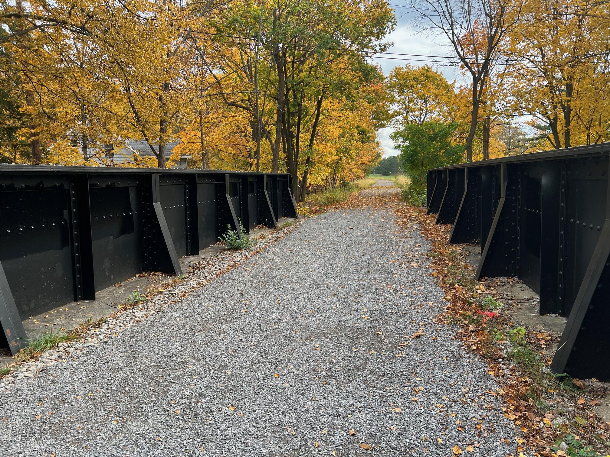
- large rail bridge over South Buffalo Street,
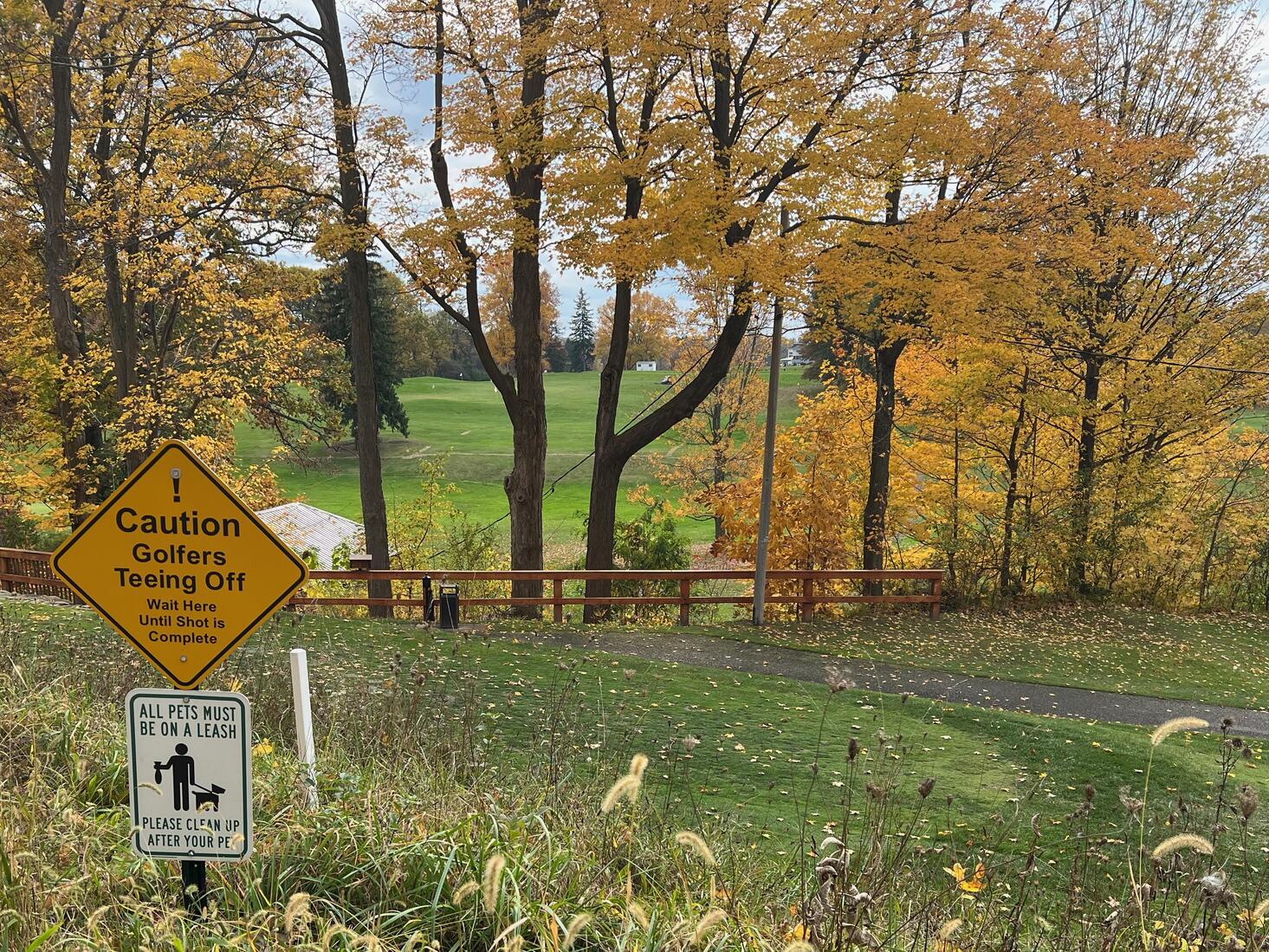
- Orchard Park Country Club (watch out for golfers teeing off),
History
From Erie Cattaraugus Rail Trail Just the Facts![]() page:
page:
Buffalo & Pittsburgh Railroad owns the land and the railroad right-of-way. The railroad has not abandoned its interest in operating a railroad on the property. It is private property and is owned “fee simple” which means the railroad holds the title. The railroad has railbanked its property for interim use as a trail to preserve it for the possibility of future rail restoration.
The Surface Transportation Board (STB) approved the railroad’s Notice of Interim Trail Use as a multi-purpose trail. ECRT was named trail manager in 2018 through a federal railbanking agreement. This corridor has been identified by the STB as a significant national transportation asset that needs to be protected and preserved for potential reuse. The railbanking order stipulates that ECRT is to develop a multiuse trail on this corridor.
The federal government has jurisdiction over the corridor. This preempts local and state jurisdiction of its use. Even though it is private property, the use of the property is regulated by the STB since Congress regulates interstate commerce. It’s still a transportation corridor, with train traffic being replaced by trail users. It can be replaced by rail traffic again in the future. It is a railroad right of way that is being used as a trail in the interim.
Adam Burns![]() writes on the American-Rails.Com
writes on the American-Rails.Com![]() website:
website:
The Buffalo, Rochester and Pittsburgh Railway was a western New York and Pennsylvania system that was best remembered for hauling vast amounts of coal from the region in which it served, particularly in the Keystone State.
It reached two of its namesake cities (Buffalo and Rochester) but interestingly never provided direct rail service into Pittsburgh.
Despite this it was able to reach the Steel City beginning in the 1880s thanks to trackage rights over a PRR subsidiary, and then later the Baltimore & Ohio from Butler, Pennsylvania sharing that railroad’s Smithfield Street Station in Pittsburgh.
Trail Summary
| Distance | 1.2 miles point to point | 2.2 miles out and back |
| Elevation gain | 99 feet | |
| Trail surface | Gravel | |
| Difficulty | Easy | |
| Point of Interest | 42.758615, -78.747183 |
Orchard Park Depot and rail cars |
| Bank Street Parking | 42.760013, -78.749646 |
Maybe space for about 10 cars, not paved, not striped |
Avenza Map
Avenza Map
- Load the PDF map into Avenza app on your smartphone in one of these ways:
- From your smartphone’s browser, tap this link to load the map directly into Avenza.
- From Avenza app’s Import Maps function, scan this QR code.

- Be sure to do this when you have good internet connection. Don’t wait until you are at the trailhead!
For more information about trail maps, see the Maps page.