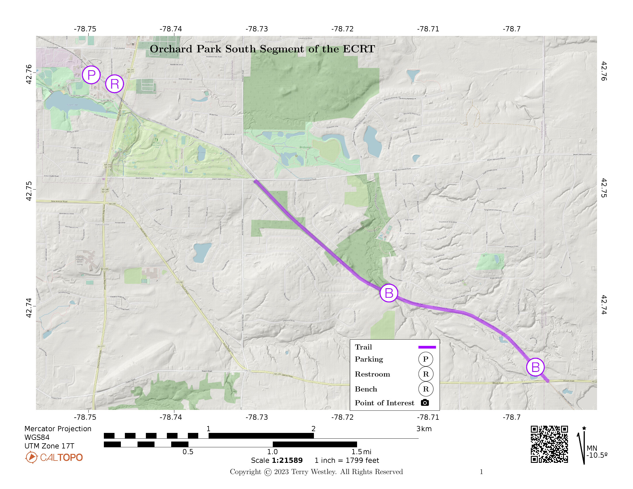
The Orchard Park South Segment of the Erie Cattaraugus Rail Trail (ECRT)![]() has Jewett Holmwood Road as its northern trailhead and Ellicott Road as its southern.
It proceeds 2.2 miles through Orchard Park, NY, with an elevation gain of approximately 156 feet.
has Jewett Holmwood Road as its northern trailhead and Ellicott Road as its southern.
It proceeds 2.2 miles through Orchard Park, NY, with an elevation gain of approximately 156 feet.
There are no parking lots at either end of the trail. There is a gravel parking lot across Ellicott from the trail end. I’ve seen cars parked there but there is no sign that it is an ECRT parking lot. There is room for a couple cars to park off Ellicott Road near the trailhead. I don’t recommend parking on Jewett Holmwood near the trailhead as there is no space off the road there. When I hiked the trail, I parked off Bank Street at the parking lot for the Orchard Park North Segment of the ECRT. That extended the round trip from 4.2 to 6.8 miles to include the north segment.
Leave No Trace, Ten Essentials
While you’re enjoying the outdoors, please leave no trace![]() to minimize your impact and preserve these special places for others to use as well. If you’re walking or hiking, please pack the REI ten essentials
to minimize your impact and preserve these special places for others to use as well. If you’re walking or hiking, please pack the REI ten essentials![]() for your own safety. When cycling, consider using this REI checklist
for your own safety. When cycling, consider using this REI checklist![]() . For other activities, review the hiking and biking essentials and use your judgement.
. For other activities, review the hiking and biking essentials and use your judgement.
Trail Surface
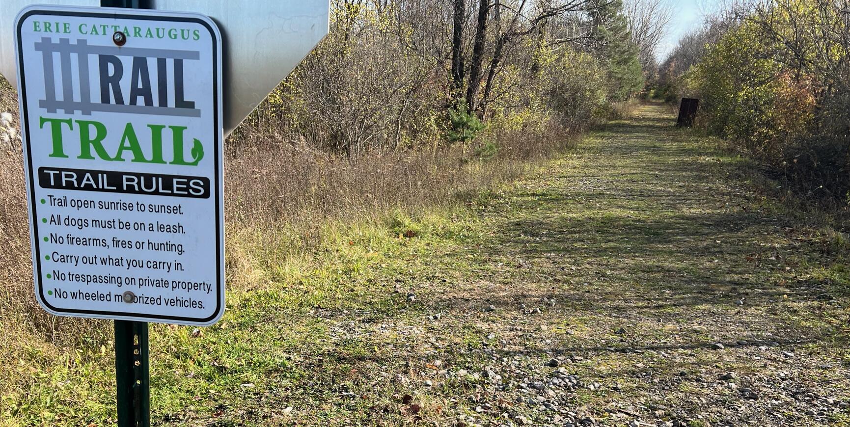
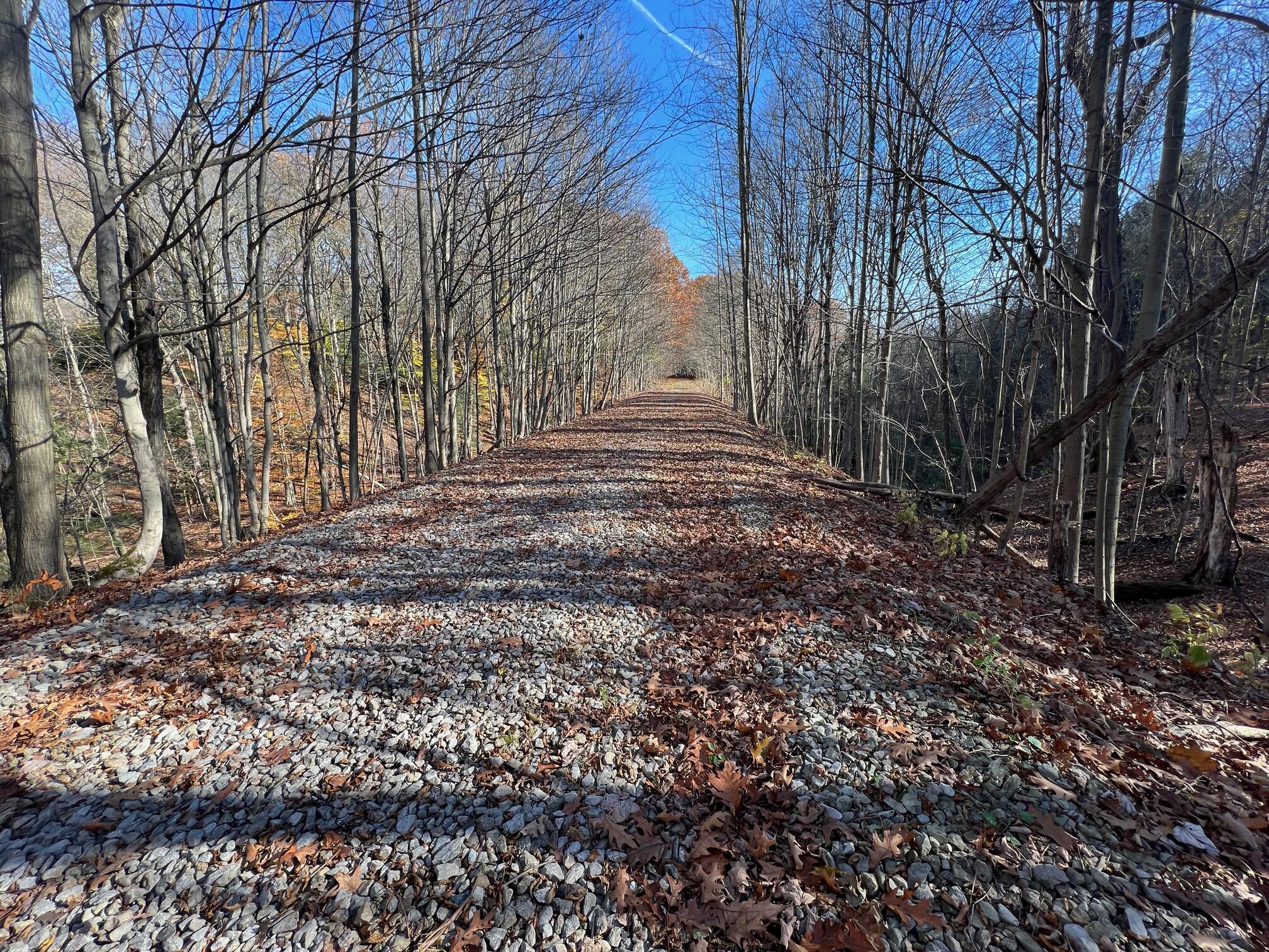
The trail surface is ballast and grass. Unless you’ve got trail tires on your wheelchair or stroller, this might not be a good trail for you. It's not likely that you’ll be able to rollerblade or use city tires on your bike.
Please consider carefully whether this trail surface is adequate for your activity.
Restrooms
There are no public restrooms at the trailheads or along the trail.
Points of Interest
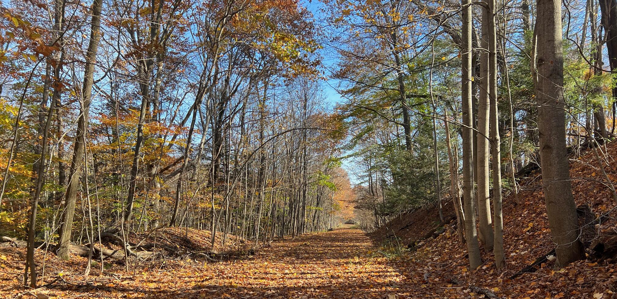
The trail is entirely in woods. For about a mile into the trail from the Jewett Holmwood trailhead, you will see many homes through the bushes and trees. Some even have their own little trail leading to the ECRT. Please stay on the main trail as these access trails are all private property even when not posted. Near the Ellicott Road trailhead, watch for some more interesting properties adjacent to the trail.
This is a really good trail for appreciating the railroad engineering of leveling the hills and valleys for gentle slopes and curves.
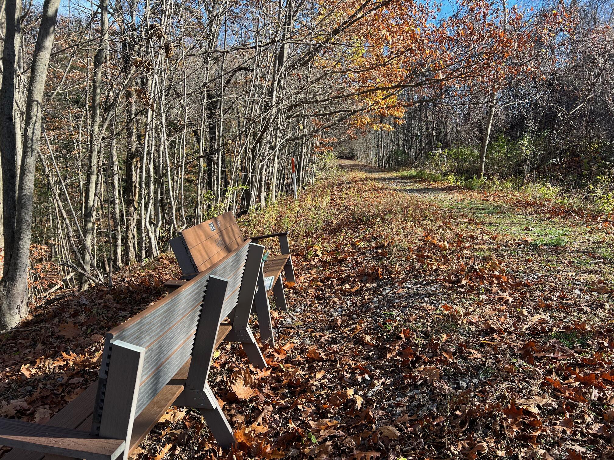
There are several park benches along the way. One is within sight of the Ellicott Road trailhead. The other is at approximately the midpoint of the trail. See the map. According to the signs on the benches, we can thank Girl Scout Troop 30350 with material donated by Lowe's of Orchard Park.
History
From Erie Cattaraugus Rail Trail Just the Facts![]() page:
page:
Buffalo & Pittsburgh Railroad owns the land and the railroad right-of-way. The railroad has not abandoned its interest in operating a railroad on the property. It is private property and is owned “fee simple” which means the railroad holds the title. The railroad has railbanked its property for interim use as a trail to preserve it for the possibility of future rail restoration.
The Surface Transportation Board (STB) approved the railroad’s Notice of Interim Trail Use as a multi-purpose trail. ECRT was named trail manager in 2018 through a federal railbanking agreement. This corridor has been identified by the STB as a significant national transportation asset that needs to be protected and preserved for potential reuse. The railbanking order stipulates that ECRT is to develop a multiuse trail on this corridor.
The federal government has jurisdiction over the corridor. This preempts local and state jurisdiction of its use. Even though it is private property, the use of the property is regulated by the STB since Congress regulates interstate commerce. It’s still a transportation corridor, with train traffic being replaced by trail users. It can be replaced by rail traffic again in the future. It is a railroad right of way that is being used as a trail in the interim.
Adam Burns![]() writes on the American-Rails.Com
writes on the American-Rails.Com![]() website:
website:
The Buffalo, Rochester and Pittsburgh Railway was a western New York and Pennsylvania system that was best remembered for hauling vast amounts of coal from the region in which it served, particularly in the Keystone State.
It reached two of its namesake cities (Buffalo and Rochester) but interestingly never provided direct rail service into Pittsburgh.
Despite this it was able to reach the Steel City beginning in the 1880s thanks to trackage rights over a PRR subsidiary, and then later the Baltimore & Ohio from Butler, Pennsylvania sharing that railroad’s Smithfield Street Station in Pittsburgh.
Hiking Solo (and Running, etc.)
Suppose you park at Bank Street and then traverse both Orchard Park North and Orchard Park South. But you’re not confident you can traverse back to Bank Street. In that case, consider using a ride share like Uber or Lyft to get back to where you parked. Since this trail is in a populated area, you won’t have long to wait for a ride. I’ve done this several times because I usually hike solo.
Trail Summary
| Distance | 2.2 miles point to point | 4.2 miles out and back |
| Elevation gain | 156 feet | |
| Trail surface | Ballast and grass | |
| Difficulty | Easy | |
| Bank Street Parking | 42.760013, -78.749646 |
Space for about 10 cars, not paved, not striped |
| Ellicott Road Parking | 42.73367, -78.696533 |
Space for 2-3 cars by the trail side of the road |
Avenza Map
Avenza Map
- Load the PDF map into Avenza app on your smartphone in one of these ways:
- From your smartphone’s browser, tap this link to load the map directly into Avenza.
- From Avenza app’s Import Maps function, scan this QR code.

- Be sure to do this when you have good internet connection. Don’t wait until you are at the trailhead!
For more information about trail maps, see the Maps page.