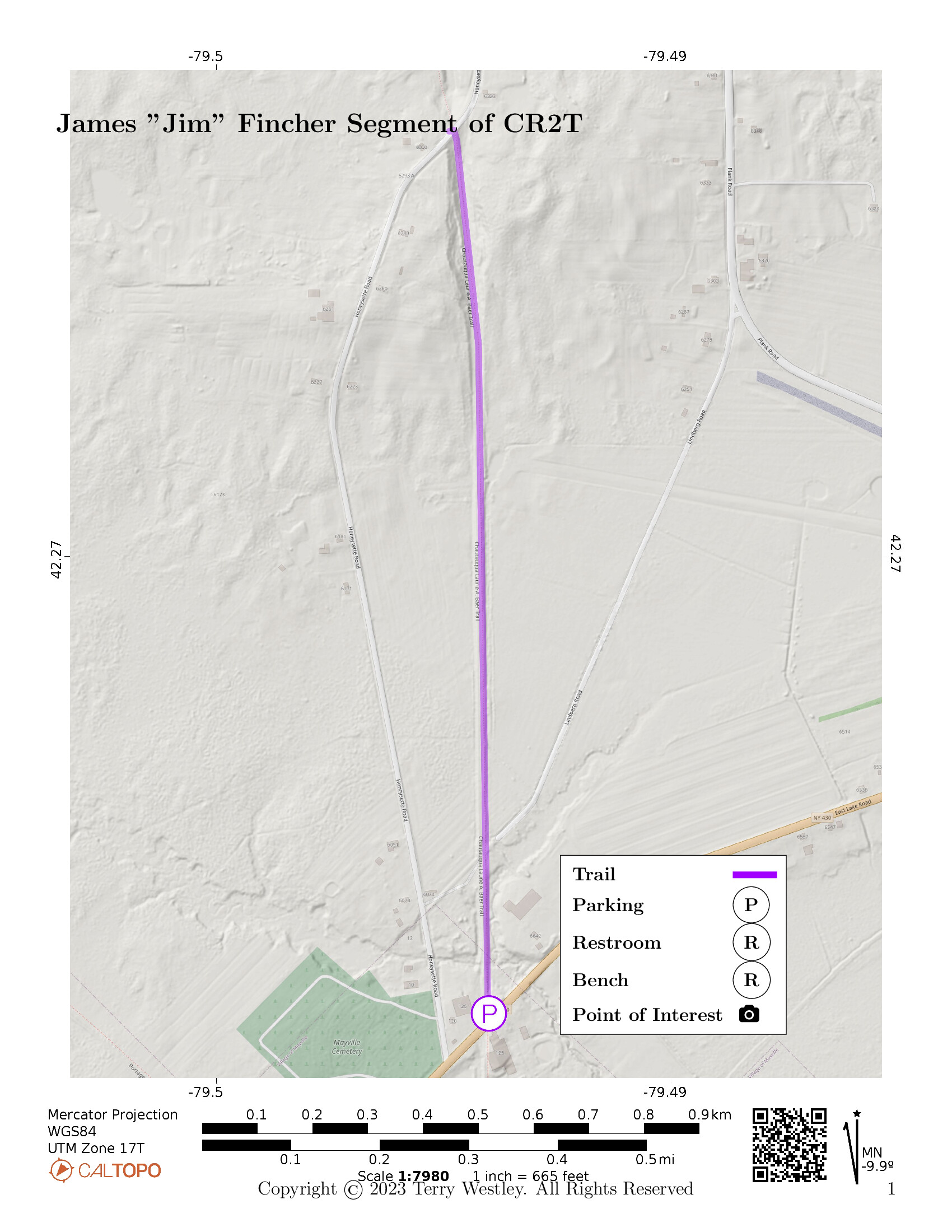
The James “Jim” Fincher Trail of the Chautauqua Rails To Trails (CR2T)![]() is a one mile rail trail near Mayville, NY.
It is built on a railbed of the Pennsylvania Railroad’s Chautauqua Branch.
Its southern trailhead is on East Chautauqua Street (AKA East Lake Street and NY 430) while its northern is on Honeysette Road.
The total elevation gain is 49 feet.
is a one mile rail trail near Mayville, NY.
It is built on a railbed of the Pennsylvania Railroad’s Chautauqua Branch.
Its southern trailhead is on East Chautauqua Street (AKA East Lake Street and NY 430) while its northern is on Honeysette Road.
The total elevation gain is 49 feet.
North of Honeysette Road, the trail is closed to Plank Road from October 1st to January 1st for hunting.
If you continue on the trail south across East Chautauqua Street, you will be on the paved Mayville Village Trail.
Besides our map below, see also CR2T’s map of the trail![]() .
.
Leave No Trace, Ten Essentials
While you’re enjoying the outdoors, please leave no trace![]() to minimize your impact and preserve these special places for others to use as well. If you’re walking or hiking, please pack the REI ten essentials
to minimize your impact and preserve these special places for others to use as well. If you’re walking or hiking, please pack the REI ten essentials![]() for your own safety. When cycling, consider using this REI checklist
for your own safety. When cycling, consider using this REI checklist![]() . For other activities, review the hiking and biking essentials and use your judgement.
. For other activities, review the hiking and biking essentials and use your judgement.
Parking
There is limited parking (2-3 cars) at the intersection of the trail and East Chautauqua Street. The area is not paved.
Instead, we recommend that you park at the Mayville Depot Parking where there is plenty of paved, striped parking with designated handicap spots. From there, it’s only one mile via the Mayville Village Trail to the East Chautauqua Street trailhead of the James “Jim” Fincher Trail.
Trail Surface
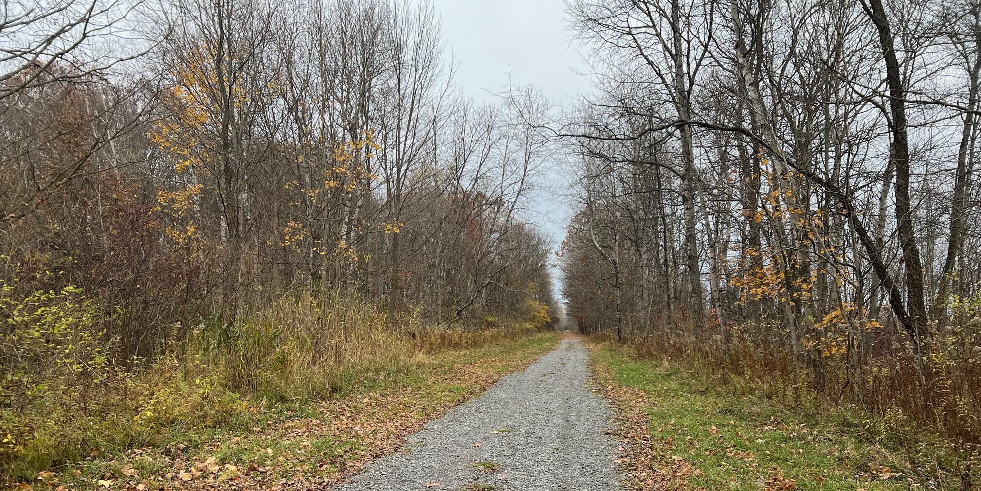
The trail surface is gravel for the entire mile from East Chautauqua Street to Honeysette Road.
Please consider carefully whether this trail surface is adequate for your activity.
Restrooms
There are no public restrooms at the trailheads or along the trail.
But if you were clever enough to park at the Mayville Village Depot, you may have noticed that there are public restrooms in Lakeside Park, about a ¼ mile from the Depot.
Points of Interest
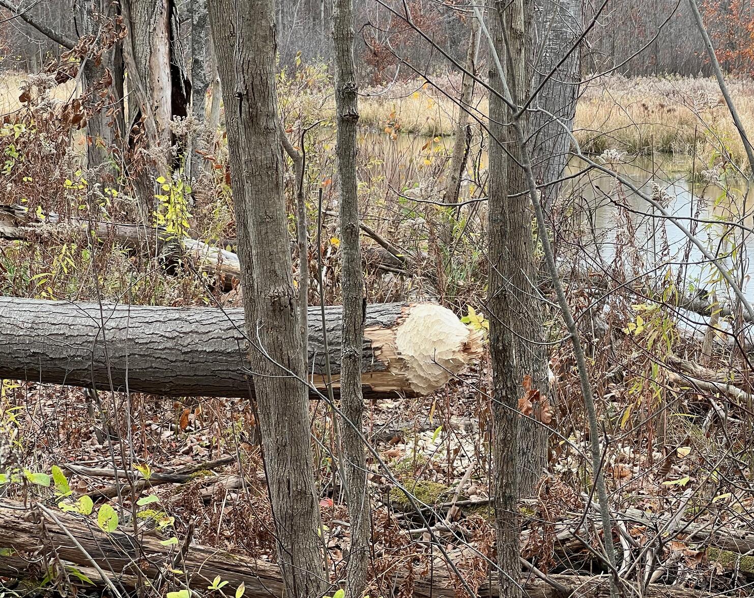
The East Chautauqua Street trailhead is in Mayville, but you will feel that you have left civilization behind as you follow the trail. The beavers were very busy cutting down trees between the trail and a stream on the east side of the trail.
There are no park benches along the way.
History
From “Jim Fincher Retiring As Rails To Trails President,” The Post-Journal, Oct 2, 2021![]() :
:
Chautauqua Rails to Trails is undergoing a transition period which is celebratory of both the past and of the future.
The organization’s annual meeting was held recently on the patio of the Carlson Center at Mayville Park. It was Jim Fincher’s last meeting after a 22-year tenure as trail manager and later as president. The organization is honoring Fincher by naming a trail segment after him, a one-mile stretch between Route 430 and Honeysette Road in Mayville. Improvements to the surface of that popular trail will occur in the next year.
“Being associated with Rails to Trails for these many years has been a wonderful experience. The people we worked with have been great. Underneath all our activity is the idea that the trails are for everyone’s use, to gain knowledge of nature, quiet solitude and a wonderful way to get exercise leading to good health,” Fincher said.
Hiking Solo (and Running, etc.)
Solo hikers who find themselves able to do the whole point-to-point trail distance but not the out and back may consider using Uber or Lyft to get a ride from where they parked to the other trailhead. Since this trail is in a less populated area, you may have to wait 15 minutes or more for a ride or you may not get a ride at all. I’ve done this several times because I usually hike solo.
Trail Summary
| Distance | 1 mile point to point | 2 miles out and back |
| Elevation gain | 49 feet | |
| Trail surface | Gravel | |
| Difficulty | Easy | |
| East Chautauqua Street Parking | 42.26258, -79.49401 |
2-3 cars, not paved |
| Mayville Depot Parking | 42.24489, -79.49565 |
Plenty of paved, striped parking |
Avenza Map
Avenza Map
- Load the PDF map into Avenza app on your smartphone in one of these ways:
- From your smartphone’s browser, tap this link to load the map directly into Avenza.
- From Avenza app’s Import Maps function, scan this QR code.

- Be sure to do this when you have good internet connection. Don’t wait until you are at the trailhead!
For more information about trail maps, see the Maps page.