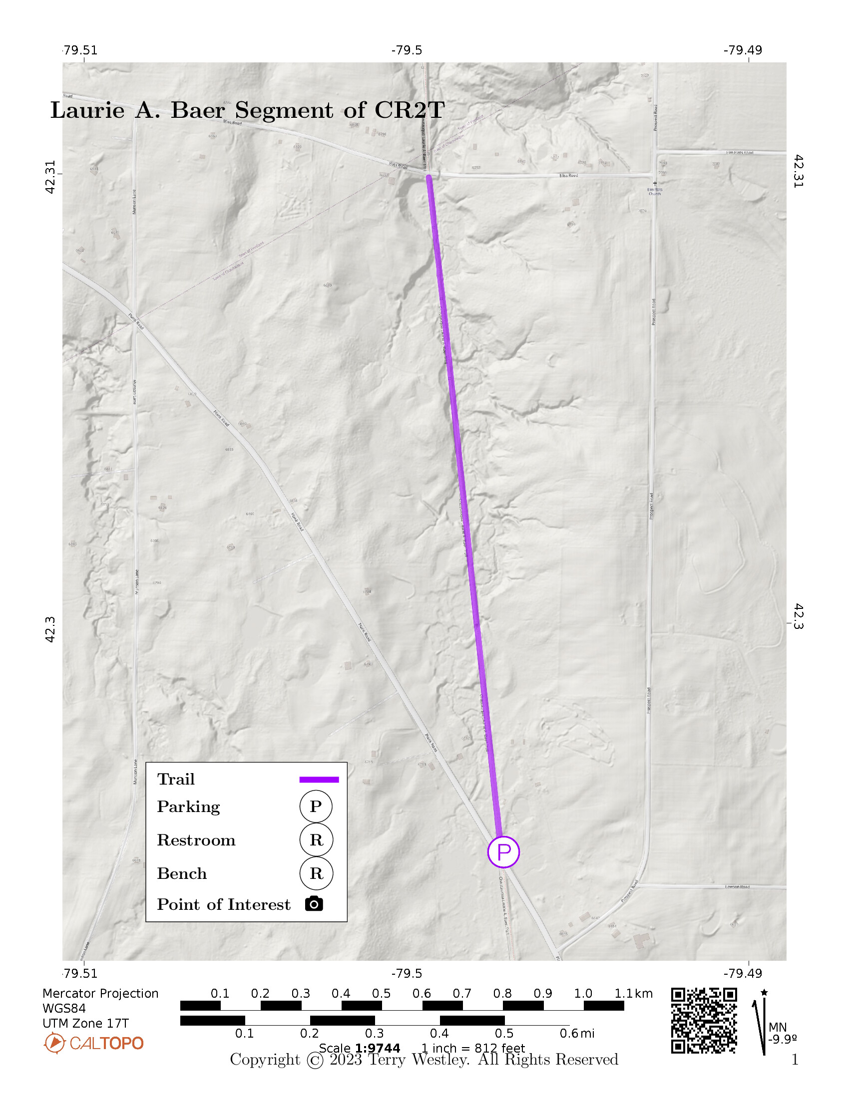
The Laurie A. Baer Segment of the Chautauqua Rails To Trails (CR2T)![]() is a one mile rail trail near Mayville, NY.
Its southern trailhead is on Plank Road while its northern is on Bliss Road.
The total elevation gain is 56 feet.
Power transmission lines extend overhead for the entire trail as this is a Niagara Mohawk right-of-way.
The lines are supported by pairs of wood poles.
is a one mile rail trail near Mayville, NY.
Its southern trailhead is on Plank Road while its northern is on Bliss Road.
The total elevation gain is 56 feet.
Power transmission lines extend overhead for the entire trail as this is a Niagara Mohawk right-of-way.
The lines are supported by pairs of wood poles.
If you cross Bliss Road and continue north on the
Chautauqua Rails To Trails (CR2T)![]() ,
you will be on the Alison Wells Ney Trail.
,
you will be on the Alison Wells Ney Trail.
Leave No Trace, Ten Essentials
While you’re enjoying the outdoors, please leave no trace![]() to minimize your impact and preserve these special places for others to use as well. If you’re walking or hiking, please pack the REI ten essentials
to minimize your impact and preserve these special places for others to use as well. If you’re walking or hiking, please pack the REI ten essentials![]() for your own safety. When cycling, consider using this REI checklist
for your own safety. When cycling, consider using this REI checklist![]() . For other activities, review the hiking and biking essentials and use your judgement.
. For other activities, review the hiking and biking essentials and use your judgement.
Parking
There is no parking lot on Bliss Road but there may be room to park on the side of the road. The Plank Road trailhead has a short access road that is shared with private property. About 5-10 cars could park off this access road depending on how many are comfortable with parking off-road. The area is not paved.
Trail Surface
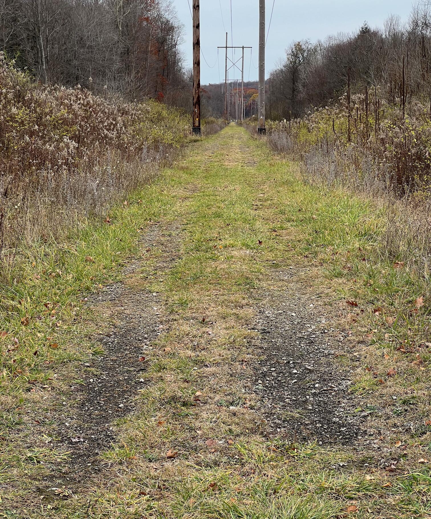
The trail surface is grass, gravel, and ballast. It is a little wider than an automobile and there are minor ruts extending the entire trail indicating some vehicle usage. The minor ruts have more gravel and ballast than the center which is almost exclusively grass. You’ll find the going a little bumpy whichever route you take.
Please consider carefully whether this trail surface is adequate for your activity.
Restrooms
There are no public restrooms at the trailheads or along the trail.

Points of Interest
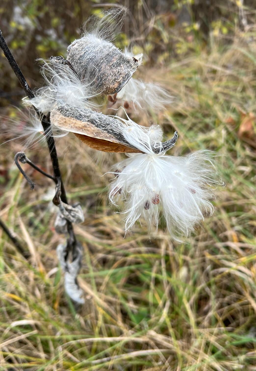
The trail is entirely in wetlands and woodlands so flora and fauna are the main attractions. If you’re not that into flora and fauna, then recall that it is often better to be outside than inside.
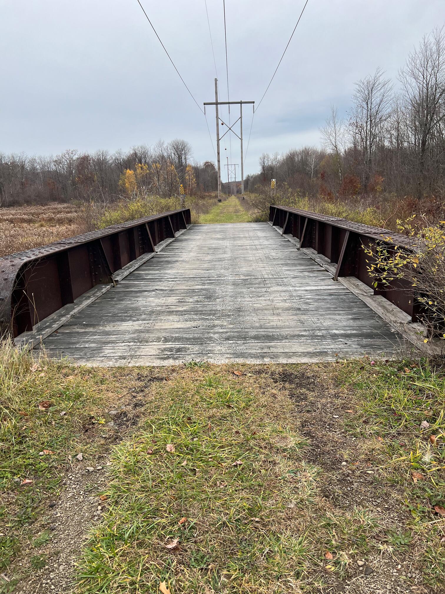
The steel railroad bridge on the trail may be original but I couldn’t confirm that.
There are no park benches along the way.
History
William Mohan writes in the August 25, 2019, edition of the Jamestown Post-Journal![]() ,
,
Originally started in 1991, Chautauqua County Rails To Trails has been working to provide means of natural conservation for the community.
At the same time, the group also tries to preserve trails that once served as crucial points of infrastructure on railroad networks in the United States.
Rails To Trails was originally formed by Dr. Bob Berke and attorney John Goodell. However, CR2T president Jim Fincher refers to Goodell as “the spark-plug” that started the organization.
The reason for this is that Goodell learned the former Pennsylvania Railroad (Pennsy) right-of-way from Brocton to Corry, Pa., and Oil City, Pa., (running through Mayville and Sherman) was for sale.
Previously, the line had been the Chautauqua Branch line run by the Pennsy from the late 19th Century to 1968. It then became the property of the Penn Central railroad (a merger with the Pennsy, its rival: New York Central and the New Haven railroads). Due to financial hardships that plagued the company, Penn Central only lasted eight years and the Chautauqua Branch was abandoned in 1975 (the company’s final full year).
Hiking Solo (and Running, etc.)
Solo hikers who find themselves able to do the whole point-to-point trail distance but not the out and back may consider using Uber or Lyft to get a ride from where they parked to the other trailhead. Since this trail is in a less populated area, you may have to wait 15 minutes or more for a ride or you may not get a ride at all. I’ve done this several times because I usually hike solo.
Trail Summary
| Distance | 1 mile point to point | 2 miles out and back |
| Elevation gain | 56 feet | |
| Trail surface | Grass, gravel, and ballast | |
| Difficulty | Easy | |
| Plank Road Parking | 42.29490, -79.49737 |
5-10 cars, not paved |
Avenza Map
Avenza Map
- Load the PDF map into Avenza app on your smartphone in one of these ways:
- From your smartphone’s browser, tap this link to load the map directly into Avenza.
- From Avenza app’s Import Maps function, scan this QR code.

- Be sure to do this when you have good internet connection. Don’t wait until you are at the trailhead!
For more information about trail maps, see the Maps page.