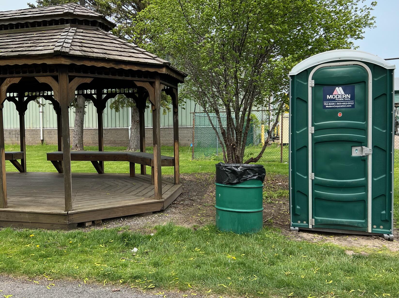
If you’re looking for creature comforts, this is the trail for you. The trail is paved from start to finish, has plenty of park benches for rest, and even several gazebos for rest or picnics.
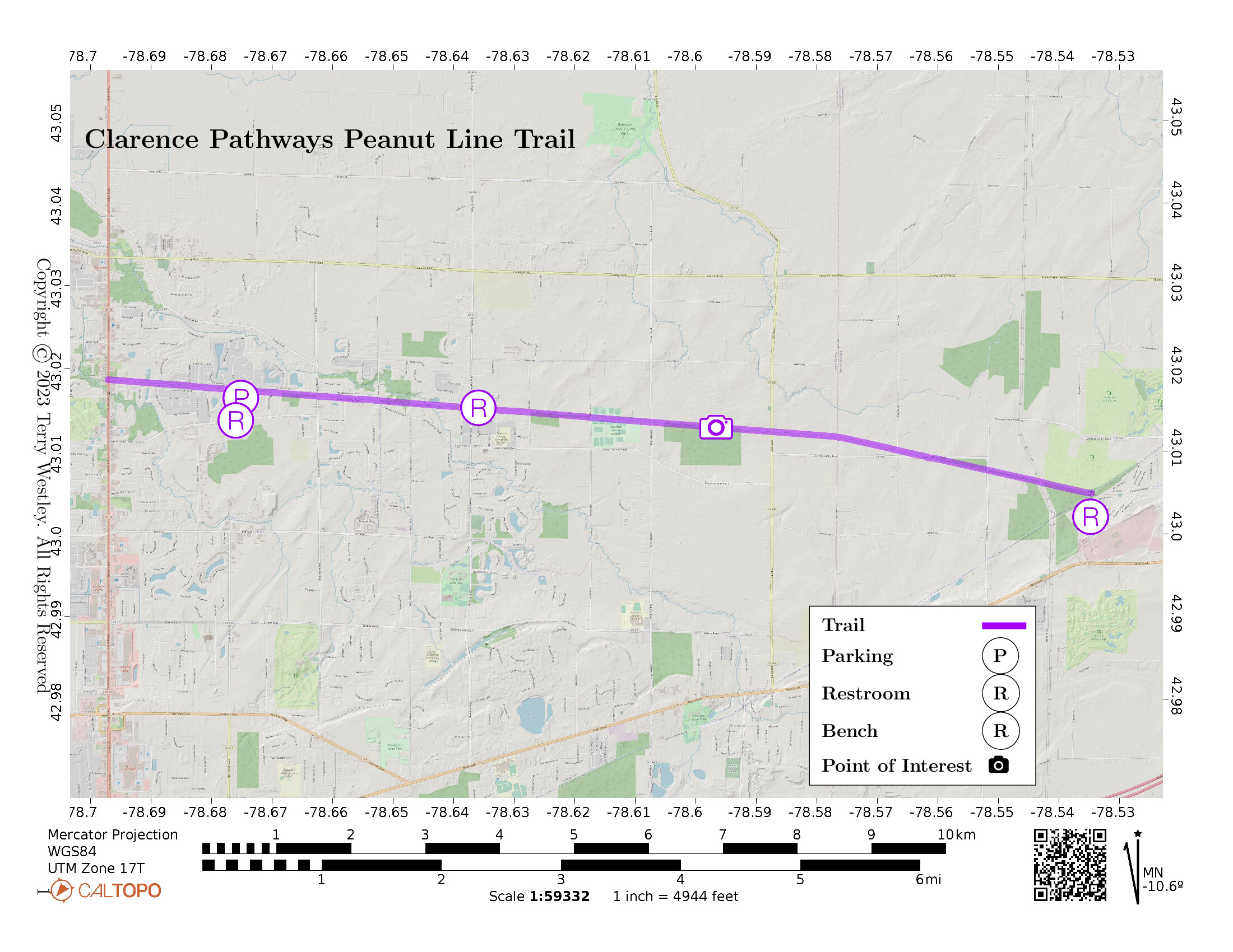
Built on the New York Central’s Batavia Line, the Clarence Pathways Peanut Line Trail, AKA Town of Clarence Bike Trail, is a 7.2 miles point to point rail trail.
The trail starts at Meadowlakes Park and ends at the Newstead-Akron Bike Path.
The Town of Clarence has a useful map![]() of this trail with lots of other handy information.
of this trail with lots of other handy information.
Local parks along the trail include Meadowlakes Park![]() and Memorial Park Soccer Center
and Memorial Park Soccer Center![]() .
.
Leave No Trace, Ten Essentials
While you’re enjoying the outdoors, please leave no trace![]() to minimize your impact and preserve these special places for others to use as well. If you’re walking or hiking, please pack the REI ten essentials
to minimize your impact and preserve these special places for others to use as well. If you’re walking or hiking, please pack the REI ten essentials![]() for your own safety. When cycling, consider using this REI checklist
for your own safety. When cycling, consider using this REI checklist![]() . For other activities, review the hiking and biking essentials and use your judgement.
. For other activities, review the hiking and biking essentials and use your judgement.
Trail Surface
The trail is paved end to end and is in fairly good condition. There are lots of cross streets, all of which are level with the trail, no curbs. The trail is slightly higher than the Meadowlakes Park parking area but there is a ramp, no steps.
Please consider carefully whether this trail surface is adequate for your activity.
Restrooms
Public restrooms are available at Meadowlakes Park, Village Mill (Goodrich Road), and at the intersection with the Newstead-Akron Bike Path (portable toilets).
Points of Interest
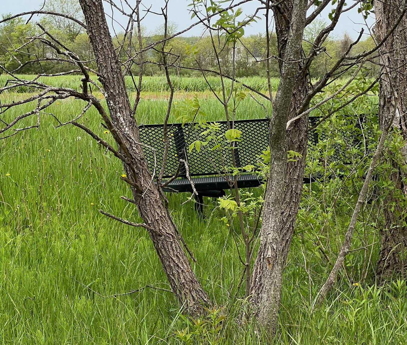
There is an odd park bench that is twenty feet off the trail behind a row of trees. No doubt there’s some history behind this but I haven’t discovered it yet.
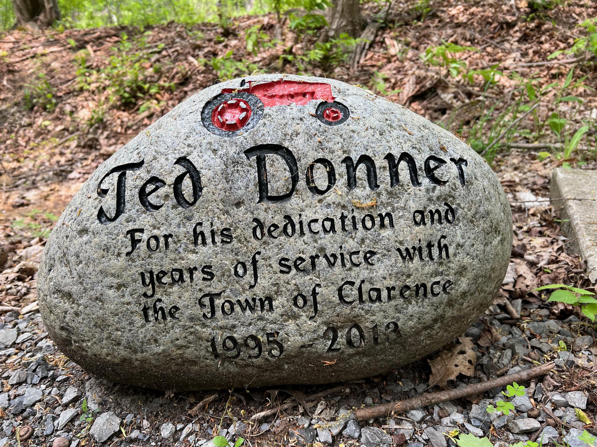
This stone marker dedicated to Ted Donner “for his dedication and years of service with the Town of Clarence 1995 - 2013,” is one of several memorial markers and park benches.
History
John G. Sheret writes in the Spring-Summer 2007 edition of![]() :
:
January 1, 1853, proved to be an exciting day for the residents of Honeoye Falls when the first train of the newly built Canandaigua to Batavia Railroad arrived in the village. Large crowds turned out for the event and everyone was offered a free ride to Batavia and back.
By July 1st of that year the railroad was extended to Niagara Falls, and on July 28th, the first passenger train, operated as an excursion train, ran over the completed road. Historical accounts differ on whether the line was acquired by the New York Central Railroad in 1855 or 1857. In any event it became known as the “Peanut Line” after Dean Richmond, a company vice-president, referred to the acquisition as “only a peanut of a line.” The official New York Central designation for the line was the “Batavia Branch.”
Hiking Solo (and Running, etc.)
Solo hikers who find themselves able to do the whole point-to-point trail distance but not the out and back may consider using Uber or Lyft to get a ride from where they parked to the other trailhead. Then you can walk to your car from there. Since this trail is in a populated area, you won’t have long to wait for a ride. I’ve done this several times (on other trails) because I usually hike solo.
Trail Summary
| Distance | 7.2 miles point to point | 14.4 miles out and back |
| Elevation gain | 145 feet | |
| Trail surface | Asphalt | |
| Difficulty | Easy | |
| Point of Interest | 43.010794,-78.570617 |
Hide and seek park bench |
| Point of Interest | 43.01289, -78.59663 |
Ted Donner Memorial Stone |
| Meadow Lakes Park Parking | 43.01620, -78.67659 |
Plenty, not striped |
Avenza Map
Avenza Map
- Load the PDF map into Avenza app on your smartphone in one of these ways:
- From your smartphone’s browser, tap this link to load the map directly into Avenza.
- From Avenza app’s Import Maps function, scan this QR code.

- Be sure to do this when you have good internet connection. Don’t wait until you are at the trailhead!
For more information about trail maps, see the Maps page.